Approximate Location Map
Large Map »
Latitude: 51.3952 / 51°23'42"N
Longitude: 0.2796 / 0°16'46"E
OS Eastings: 558686
OS Northings: 168701
OS Grid: TQ586687
Mapcode National: GBR X8.WP5
Mapcode Global: VHHP7.S6N9
Plus Code: 9F3297WH+3R
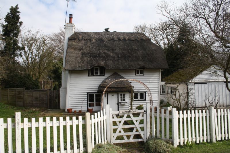
Entry Name: Whitefield
Listing Date: 22 October 1982
Grade: II
Source: Historic England
Source ID: 1238783
English Heritage Legacy ID: 416406
ID on this website: 101238783
Location: Sevenoaks, Kent, DA4
County: Kent
District: Sevenoaks
Civil Parish: Horton Kirby and South Darenth
Traditional County: Kent
Lieutenancy Area (Ceremonial County): Kent
Church of England Parish: Horton Kirby St Mary
Church of England Diocese: Rochester
Tagged with: Building Thatched building
HORTON KIRBY DEAN BOTTOM
1.
5280
South Darenth
Whitefield
TQ 56 NE 3/169
II GV
2.
C17 or earlier timber-framed building refronted in C18. Two storeys faced with
weatherboarding. Thatched roof. Two casement windows.
Listing NGR: TQ5868668701
External links are from the relevant listing authority and, where applicable, Wikidata. Wikidata IDs may be related buildings as well as this specific building. If you want to add or update a link, you will need to do so by editing the Wikidata entry.


Other nearby listed buildings
