Approximate Location Map
Large Map »
Latitude: 51.5063 / 51°30'22"N
Longitude: -0.1292 / 0°7'45"W
OS Eastings: 529931
OS Northings: 180260
OS Grid: TQ299802
Mapcode National: GBR HG.46
Mapcode Global: VHGQZ.QD1L
Plus Code: 9C3XGV4C+G8
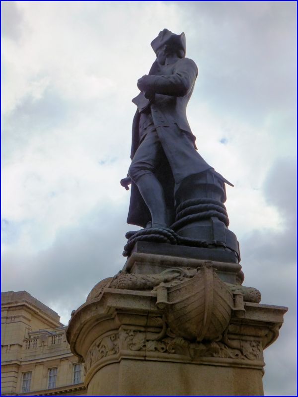
Entry Name: Statue of Captain Cook
Listing Date: 5 February 1970
Grade: II
Source: Historic England
Source ID: 1239083
English Heritage Legacy ID: 416818
ID on this website: 101239083
Location: Whitehall, Westminster, London, SW1A
County: London
District: City of Westminster
Electoral Ward/Division: St James's
Parish: Non Civil Parish
Built-Up Area: City of Westminster
Traditional County: Middlesex
Lieutenancy Area (Ceremonial County): Greater London
Church of England Parish: St Martin-in-the-Fields
Church of England Diocese: London
Tagged with: Statue
TQ 2980 SE CITY OF WESTMINSTER THE MALL, SW1
82/68 (north east side)
5.2.70 Statue of Captain Cook
G.V. II
Statue. 1914 by Sir Thomas Brock. Bronze standing figure on shaped
Portland stone pedestal.
Listing NGR: TQ2993180260
External links are from the relevant listing authority and, where applicable, Wikidata. Wikidata IDs may be related buildings as well as this specific building. If you want to add or update a link, you will need to do so by editing the Wikidata entry.


Other nearby listed buildings
