Latitude: 50.721 / 50°43'15"N
Longitude: -3.5225 / 3°31'20"W
OS Eastings: 292625
OS Northings: 92367
OS Grid: SX926923
Mapcode National: GBR P1.9274
Mapcode Global: FRA 37H5.RHG
Plus Code: 9C2RPFCH+92
Entry Name: Wall of Magdalen Almshouses
Listing Date: 18 June 1974
Grade: II
Source: Historic England
Source ID: 1239482
English Heritage Legacy ID: 417366
ID on this website: 101239482
Location: Barnfield, Exeter, Devon, EX2
County: Devon
District: Exeter
Electoral Ward/Division: Newtown and St Leonard's
Parish: Non Civil Parish
Built-Up Area: Exeter
Traditional County: Devon
Lieutenancy Area (Ceremonial County): Devon
Church of England Parish: Exeter St Leonard
Church of England Diocese: Exeter
Tagged with: Wall
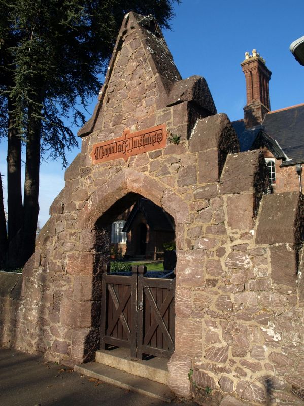
MAGDALEN ROAD
1.
1092
(North Side)
Wall of Magdalen Almshouses
SX 9292 SE 7/1022A
II GV
2.
Contemporary with the building. Purple stone with entrance archway.
Magdalen Almshouses (Nos 1 to 16 (consec)) and wall form a group.
Listing NGR: SX9262592367
External links are from the relevant listing authority and, where applicable, Wikidata. Wikidata IDs may be related buildings as well as this specific building. If you want to add or update a link, you will need to do so by editing the Wikidata entry.


Other nearby listed buildings