Approximate Location Map
Large Map »
Latitude: 51.4965 / 51°29'47"N
Longitude: -0.254 / 0°15'14"W
OS Eastings: 521300
OS Northings: 178950
OS Grid: TQ213789
Mapcode National: GBR 9M.DMZ
Mapcode Global: VHGQX.KN24
Plus Code: 9C3XFPWW+HC
Entry Name: 6, Priory Gardens W4
Listing Date: 2 February 1970
Grade: II
Source: Historic England
Source ID: 1240255
English Heritage Legacy ID: 438392
ID on this website: 101240255
Location: Bedford Park, Hounslow, London, W4
County: London
District: Hounslow
Electoral Ward/Division: Chiswick Homefields
Parish: Non Civil Parish
Built-Up Area: Hounslow
Traditional County: Middlesex
Lieutenancy Area (Ceremonial County): Greater London
Church of England Parish: St Michael and All Angels Bedford Park
Church of England Diocese: London
Tagged with: Building
1.
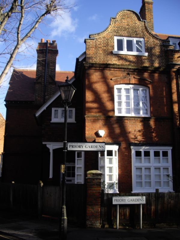
4419 PRIORY GARDENS W4
(Bedford Park)
No 6
TQ 2178 NW 7/19 2.2.70.
II
2.
A set back addition to the row numbered 2 to 5. Generally similar character.
Row with Dutch gables and shell door hoods. Oriel windows to ground storey.
Listing NGR: TQ2130078950
External links are from the relevant listing authority and, where applicable, Wikidata. Wikidata IDs may be related buildings as well as this specific building. If you want to add or update a link, you will need to do so by editing the Wikidata entry.


Other nearby listed buildings
