Approximate Location Map
Large Map »
Latitude: 51.4973 / 51°29'50"N
Longitude: -0.2545 / 0°15'16"W
OS Eastings: 521265
OS Northings: 179039
OS Grid: TQ212790
Mapcode National: GBR 9M.6KH
Mapcode Global: VHGQX.JMVJ
Plus Code: 9C3XFPWW+W6
Entry Name: 20, Woodstock Road W4
Listing Date: 2 February 1970
Grade: II
Source: Historic England
Source ID: 1240370
English Heritage Legacy ID: 438783
ID on this website: 101240370
Location: Bedford Park, Hounslow, London, W4
County: London
District: Hounslow
Electoral Ward/Division: Southfield
Parish: Non Civil Parish
Built-Up Area: Ealing
Traditional County: Middlesex
Lieutenancy Area (Ceremonial County): Greater London
Church of England Parish: St Michael and All Angels Bedford Park
Church of England Diocese: London
Tagged with: Building
1.
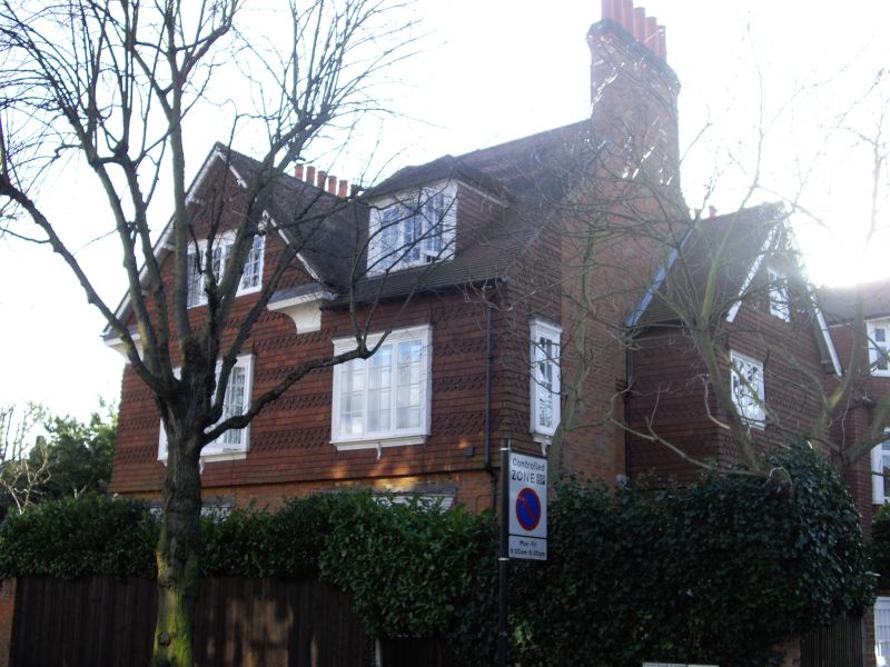
4419 WOODSTOCK ROAD W4
(Bedford Park)
No 20
TQ 2179 SW 5/7 2.2.70.
II
2.
Upper part tile hung. 2, single-storeyed bays. Porch in angle.
Listing NGR: TQ2126579039
External links are from the relevant listing authority and, where applicable, Wikidata. Wikidata IDs may be related buildings as well as this specific building. If you want to add or update a link, you will need to do so by editing the Wikidata entry.


Other nearby listed buildings
