Approximate Location Map
Large Map »
Latitude: 51.1179 / 51°7'4"N
Longitude: 0.1856 / 0°11'8"E
OS Eastings: 553068
OS Northings: 137670
OS Grid: TQ530376
Mapcode National: GBR MPV.ZP1
Mapcode Global: VHHQK.55HC
Plus Code: 9F32459P+57
Entry Name: Group of 3 Camfield Chest Tombs Approximately 2 Metres South of the Nave of the Chapel of St John
Listing Date: 24 August 1990
Grade: II
Source: Historic England
Source ID: 1240709
English Heritage Legacy ID: 439215
ID on this website: 101240709
Location: St John's Church, Groombridge, Tunbridge Wells, Kent, TN3
County: Kent
District: Tunbridge Wells
Civil Parish: Speldhurst
Traditional County: Kent
Lieutenancy Area (Ceremonial County): Kent
Church of England Parish: Speldhurst St Mary the Virgin
Church of England Diocese: Rochester
Tagged with: Chest tomb
TQ 53 37 SPELDHURST GROOMBRIDGE HILL (east side)
OLD GROOMBRIDGE
16/510 Group of 3 Camfield chest
tombs approx 2m south of the
nave of the Chapel of St John
GV II
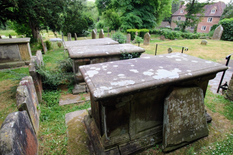
Row of 3 similar chest tombs. All dated from the 1780s in memory of members
of the Camfield family. All are sandstone ashlar. All are rectangular in
plan with corner pilasters, panelled sides, flat lids with moulded edges,
moulded bases on one-step plinths. The first, nearest the church, has plain
pilasters and panels have bead-moulded surrounds. The second has baluster-
like pilasters and plain panels, and the third has fluted baluster-like
pilasters and fielded panels. All inscriptions are similar opening with
Gothic lettering followed by Roman serif upper and lower case lettering. The
first, inscribed on the southern panel, records the death of Sarah Camfield in
1762. The second chest is inscribed on the lid and records the death of
William Camfield in 1781 (presumably the William Camfield who took over the
Groombridge Place estate and carved his name on the dedication plaque of the
chapel in 1775). The third inscription on the south panel and records the
death of John Camfield in 1788.
Listing NGR: TQ5306837670
External links are from the relevant listing authority and, where applicable, Wikidata. Wikidata IDs may be related buildings as well as this specific building. If you want to add or update a link, you will need to do so by editing the Wikidata entry.


Other nearby listed buildings
