Latitude: 51.0677 / 51°4'3"N
Longitude: -1.7994 / 1°47'58"W
OS Eastings: 414148
OS Northings: 129835
OS Grid: SU141298
Mapcode National: GBR 517.V6C
Mapcode Global: FRA 7639.JS5
Plus Code: 9C3W3692+36
Entry Name: Crane Bridge
Listing Date: 28 February 1952
Grade: I
Source: Historic England
Source ID: 1240793
English Heritage Legacy ID: 319075
ID on this website: 101240793
Location: Salisbury, Wiltshire, SP2
County: Wiltshire
Civil Parish: Salisbury
Built-Up Area: Salisbury
Traditional County: Wiltshire
Lieutenancy Area (Ceremonial County): Wiltshire
Church of England Parish: Salisbury St Thomas and St Edmund
Church of England Diocese: Salisbury
Tagged with: Road bridge
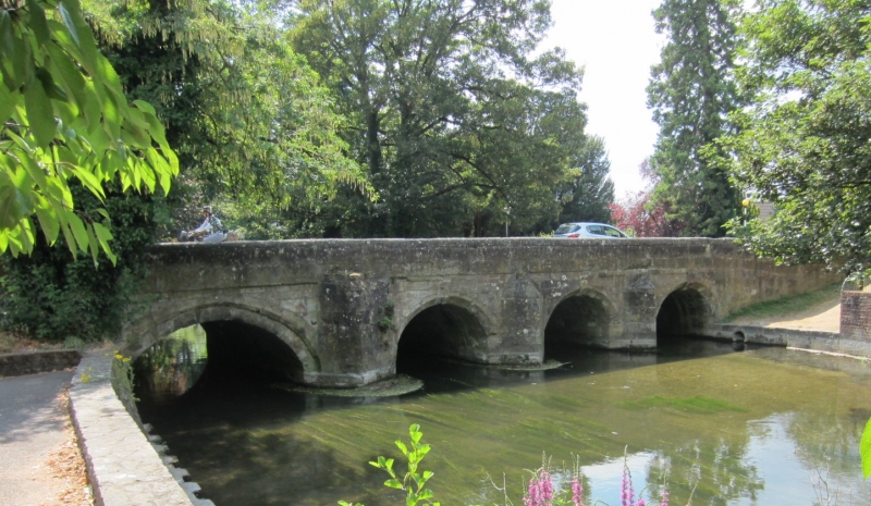
CRANE STREET
1.
1594
Crane Bridge
SU 1429 NW 3/62 28.2.52.
I
2.
C15. Stone, 4 splayed arches with projecting keystones and 4 cut-waters.
To the east of the bridge there is a smaller and lower archway. Plain stone
parapet. The south side of the bridge taken dour in 1898 and re-erected farther
out.
Listing NGR: SU1414829835
External links are from the relevant listing authority and, where applicable, Wikidata. Wikidata IDs may be related buildings as well as this specific building. If you want to add or update a link, you will need to do so by editing the Wikidata entry.


Other nearby listed buildings