Approximate Location Map
Large Map »
Latitude: 51.2817 / 51°16'54"N
Longitude: 1.0815 / 1°4'53"E
OS Eastings: 614996
OS Northings: 158127
OS Grid: TR149581
Mapcode National: GBR TY2.Q7P
Mapcode Global: VHLGM.P1MS
Plus Code: 9F3373JJ+MJ
Entry Name: 31-33, King Street
Listing Date: 7 September 1973
Grade: II
Source: Historic England
Source ID: 1240912
English Heritage Legacy ID: 439482
ID on this website: 101240912
Location: Canterbury, Kent, CT1
County: Kent
District: Canterbury
Electoral Ward/Division: Westgate
Parish: Non Civil Parish
Built-Up Area: Canterbury
Traditional County: Kent
Lieutenancy Area (Ceremonial County): Kent
Tagged with: Building
1.
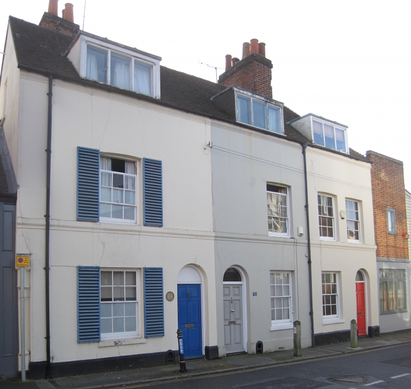
944 KING STREET
(South East Side)
Nos 31 to 33 (consec)
TR l458 SE 2/525
II GV
2.
Late C18 to early C19. 2 storeys stuccoed. Tiled roof with 3 renewed dormers.
4 cambered sashes with glazing bars intact. Ground floor has simple round-headed
doorcases with restored doors. Stringcourse. Rainwater head.
Nos 31 to 33 (consec) form a Grade II group.
Listing NGR: TR1499958126
External links are from the relevant listing authority and, where applicable, Wikidata. Wikidata IDs may be related buildings as well as this specific building. If you want to add or update a link, you will need to do so by editing the Wikidata entry.


Other nearby listed buildings
