Approximate Location Map
Large Map »
Latitude: 51.5127 / 51°30'45"N
Longitude: -0.0731 / 0°4'23"W
OS Eastings: 533807
OS Northings: 181070
OS Grid: TQ338810
Mapcode National: GBR WC.QX
Mapcode Global: VHGR0.P76P
Plus Code: 9C3XGW7G+3Q
Entry Name: Gate and End Piers and Wall to Road
Listing Date: 27 September 1973
Grade: II
Source: Historic England
Source ID: 1241049
English Heritage Legacy ID: 206073
ID on this website: 101241049
Location: Whitechapel, Tower Hamlets, London, E1
County: London
District: Tower Hamlets
Electoral Ward/Division: Whitechapel
Parish: Non Civil Parish
Built-Up Area: Tower Hamlets
Traditional County: Middlesex
Lieutenancy Area (Ceremonial County): Greater London
Church of England Parish: St George-in-the-East
Church of England Diocese: London
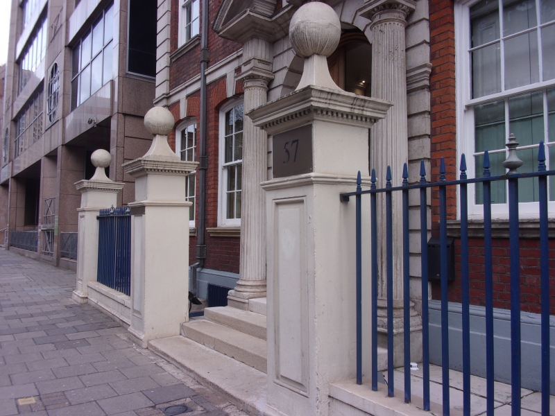
MANSELL STREET E1
1.
443l
Gate and End Piers and
Wall to road at Nos 57 & 59
TQ 3381 14/448
II
2.
Mid C18. Panelled gate and end piers with caps and ball finials linked by low
walls. All rendered white.
Listing NGR: TQ3380781070
External links are from the relevant listing authority and, where applicable, Wikidata. Wikidata IDs may be related buildings as well as this specific building. If you want to add or update a link, you will need to do so by editing the Wikidata entry.


Other nearby listed buildings
