Latitude: 51.2824 / 51°16'56"N
Longitude: 1.0763 / 1°4'34"E
OS Eastings: 614632
OS Northings: 158193
OS Grid: TR146581
Mapcode National: GBR TY2.GYC
Mapcode Global: VHLGM.L1W7
Plus Code: 9F3373JG+XG
Entry Name: 8b, North Lane
Listing Date: 7 September 1973
Grade: II
Source: Historic England
Source ID: 1241134
English Heritage Legacy ID: 440059
ID on this website: 101241134
Location: Canterbury, Kent, CT2
County: Kent
District: Canterbury
Electoral Ward/Division: Westgate
Parish: Non Civil Parish
Built-Up Area: Canterbury
Traditional County: Kent
Lieutenancy Area (Ceremonial County): Kent
Tagged with: Building
This list entry was subject to a Minor Amendment on 22 August 2025 to amend the name and address and to reformat the text to current standards
TR 1458 SE
2/346
NORTH LANE (north west side)
No 8b
(Formerly listed as No 9)
GV
II
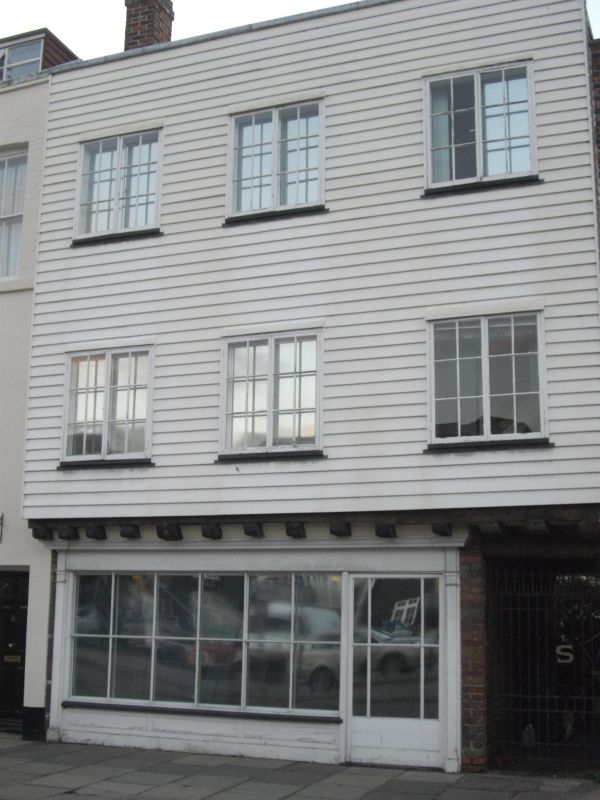
An early C19 industrial building. Three storeys weatherboarded. Two casement windows on second floor. First floor has one continuous casement and a stable door. Overhang. Ground floor has early C19 shopfront.
Nos 1, 2 & nos 4 to 15 (consec) form a group.
Listing NGR: TR1463258193
External links are from the relevant listing authority and, where applicable, Wikidata. Wikidata IDs may be related buildings as well as this specific building. If you want to add or update a link, you will need to do so by editing the Wikidata entry.


Other nearby listed buildings