Latitude: 51.2828 / 51°16'58"N
Longitude: 1.077 / 1°4'37"E
OS Eastings: 614678
OS Northings: 158241
OS Grid: TR146582
Mapcode National: GBR TY2.H3Z
Mapcode Global: VHLGM.M07X
Plus Code: 9F3373MG+4R
Entry Name: 22 and 23, North Lane
Listing Date: 7 September 1973
Grade: II
Source: Historic England
Source ID: 1241137
English Heritage Legacy ID: 440065
ID on this website: 101241137
Location: Canterbury, Kent, CT2
County: Kent
District: Canterbury
Electoral Ward/Division: Westgate
Parish: Non Civil Parish
Built-Up Area: Canterbury
Traditional County: Kent
Lieutenancy Area (Ceremonial County): Kent
Tagged with: Building
1.
944
TR 1458 SE
2/348
NORTH LANE
(North West Side)
Nos 22 and 23
II
2.
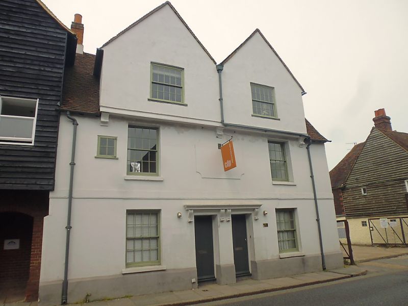
C17 timber-framed building refaced with stucco in the early C19, 2 gables
oversailing on stone brackets. Old tiled roof. Stringcourse. 2 C19 sashes.
Double doorcase having a moulded cornice supported on brackets.
Listing NGR: TR1467858241
External links are from the relevant listing authority and, where applicable, Wikidata. Wikidata IDs may be related buildings as well as this specific building. If you want to add or update a link, you will need to do so by editing the Wikidata entry.


Other nearby listed buildings