Approximate Location Map
Large Map »
Latitude: 54.2984 / 54°17'54"N
Longitude: -0.7072 / 0°42'25"W
OS Eastings: 484233
OS Northings: 489966
OS Grid: SE842899
Mapcode National: GBR RLHQ.PX
Mapcode Global: WHGBW.37H4
Plus Code: 9C6X77XV+84
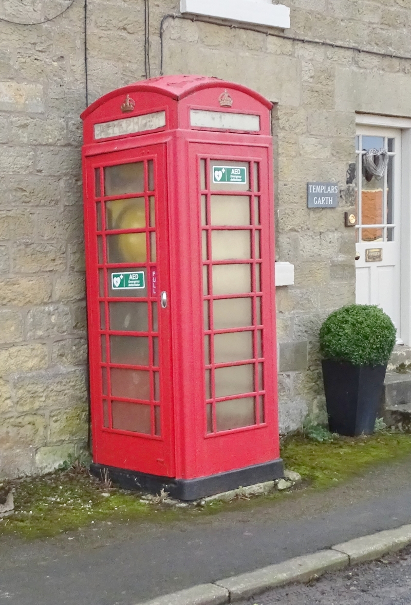
Entry Name: K6 Telephone Kiosk
Listing Date: 16 February 1990
Grade: II
Source: Historic England
Source ID: 1241498
English Heritage Legacy ID: 440566
ID on this website: 101241498
Location: Lockton, North Yorkshire, YO18
County: North Yorkshire
District: Ryedale
Civil Parish: Lockton
Traditional County: Yorkshire
Lieutenancy Area (Ceremonial County): North Yorkshire
Church of England Parish: Lockton St Giles
Church of England Diocese: York
Tagged with: K6 telephone box
The following shall be added
LOCKTON MAIN STREET
SE 88 NW
6/161 K6 Telephone Kiosk
GV II
Telephone kiosk. Type K6. Designed 1935 by Sir Giles Gilbert Scott. Made by
various contractors. Cast iron. Square kiosk with domed roof. Unperforated
crowns to top panels and margin glazing to windows and door.
Listing NGR: SE8423389966
External links are from the relevant listing authority and, where applicable, Wikidata. Wikidata IDs may be related buildings as well as this specific building. If you want to add or update a link, you will need to do so by editing the Wikidata entry.


Other nearby listed buildings
