Approximate Location Map
Large Map »
Latitude: 51.2785 / 51°16'42"N
Longitude: 1.0807 / 1°4'50"E
OS Eastings: 614953
OS Northings: 157768
OS Grid: TR149577
Mapcode National: GBR TY2.XPZ
Mapcode Global: VHLGM.P457
Plus Code: 9F3373HJ+97
Entry Name: 10, the Parade
Listing Date: 7 September 1973
Grade: II
Source: Historic England
Source ID: 1241653
English Heritage Legacy ID: 440819
ID on this website: 101241653
Location: Canterbury, Kent, CT1
County: Kent
District: Canterbury
Electoral Ward/Division: Westgate
Parish: Non Civil Parish
Built-Up Area: Canterbury
Traditional County: Kent
Lieutenancy Area (Ceremonial County): Kent
Tagged with: Building
1.
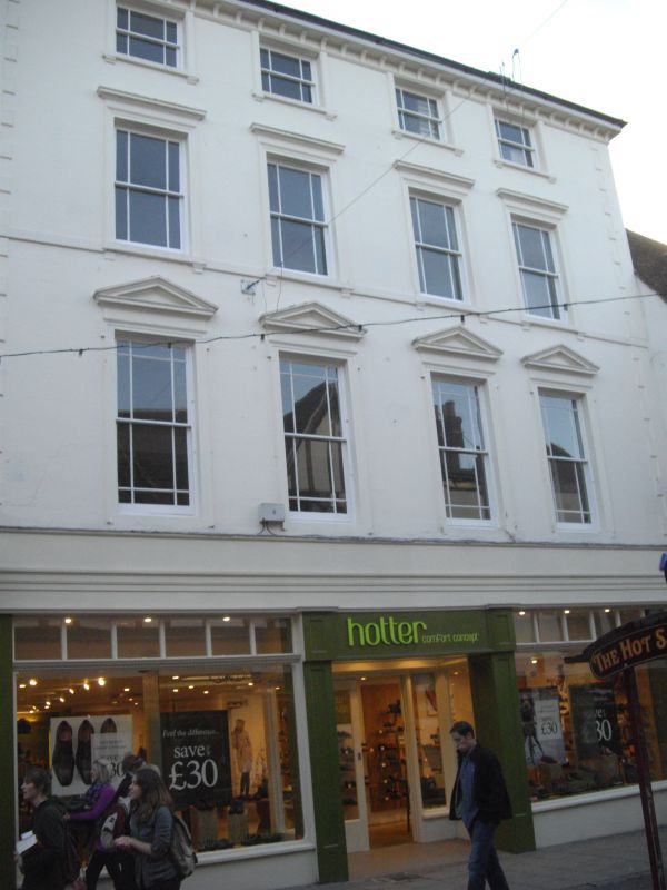
944 THE PARADE
(South West Side)
No 10
TR 1457 NE 4/642
II GV
2.
Early C19. 4 storeys stuccoed. Wooden bracket cornice and end quoins. 4
sashes set in Italianate architraves with pediments to 1st floor only. Later
shopfronts.
Nos 8 to 10 (consec) form a group.
Also form a group with Nos 25, 25A, & No 26 St Margaret's Street.
Listing NGR: TR1495057761
External links are from the relevant listing authority and, where applicable, Wikidata. Wikidata IDs may be related buildings as well as this specific building. If you want to add or update a link, you will need to do so by editing the Wikidata entry.


Other nearby listed buildings
