Latitude: 51.2813 / 51°16'52"N
Longitude: 1.0757 / 1°4'32"E
OS Eastings: 614592
OS Northings: 158063
OS Grid: TR145580
Mapcode National: GBR TY2.NS8
Mapcode Global: VHLGM.L2J3
Plus Code: 9F3373JG+G7
Entry Name: Former Church of the Holy Cross
Listing Date: 3 December 1949
Grade: II*
Source: Historic England
Source ID: 1241661
English Heritage Legacy ID: 440837
Also known as: Holy Cross Church, Canterbury, Kent
ID on this website: 101241661
Location: Canterbury, Kent, CT2
County: Kent
District: Canterbury
Electoral Ward/Division: Westgate
Parish: Non Civil Parish
Built-Up Area: Canterbury
Traditional County: Kent
Lieutenancy Area (Ceremonial County): Kent
Tagged with: Church building
This list entry was subject to a Minor Amendment on 4 October 2024 to update the name and address and reformat the text to current standards.
TR 1458 SE
2/101
ST PETERS STREET
The Guildhall
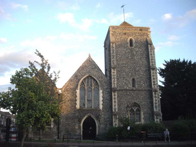
Former Church of the Holy Cross
(Formerly listed as Church of the Holy Cross, ST DUNSTAN'S STREET)
3.12.49.
II*
Built mainly in 1381 with some C15 windows. One storey flint faced with stone dressings. South west tower with hipped tiled roof.
Listing NGR: TR1459258063
External links are from the relevant listing authority and, where applicable, Wikidata. Wikidata IDs may be related buildings as well as this specific building. If you want to add or update a link, you will need to do so by editing the Wikidata entry.


Other nearby listed buildings