Approximate Location Map
Large Map »
Latitude: 51.3725 / 51°22'20"N
Longitude: 1.3043 / 1°18'15"E
OS Eastings: 630071
OS Northings: 168896
OS Grid: TR300688
Mapcode National: GBR WZW.SP9
Mapcode Global: VHLG5.KRCQ
Plus Code: 9F3398C3+XP
Entry Name: 230-238, Canterbury Road
Listing Date: 10 December 1981
Grade: II
Source: Historic England
Source ID: 1241725
English Heritage Legacy ID: 440922
ID on this website: 101241725
Location: Birchington, Thanet, Kent, CT7
County: Kent
District: Thanet
Civil Parish: Birchington
Built-Up Area: Margate
Traditional County: Kent
Lieutenancy Area (Ceremonial County): Kent
Tagged with: Building
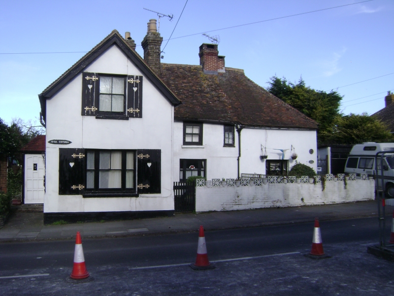
CANTERBURY ROAD
1.
BIRCHINGTON-ON-SEA
5283
Nos 230 to 238 (even)
TR 36 NW 9/117
2.
C17 timber-framed building with right side return extension of C18 and left
side projecting extension of C19. Two storeys colourwashed with hipped tiled
roof C17 brick chimney stack. C19 sash windows. Cl8 extension is of brown
brick.
Listing NGR: TR3007168896
External links are from the relevant listing authority and, where applicable, Wikidata. Wikidata IDs may be related buildings as well as this specific building. If you want to add or update a link, you will need to do so by editing the Wikidata entry.


Other nearby listed buildings
