Approximate Location Map
Large Map »
Latitude: 51.2831 / 51°16'59"N
Longitude: 1.0727 / 1°4'21"E
OS Eastings: 614375
OS Northings: 158257
OS Grid: TR143582
Mapcode National: GBR TY2.G1P
Mapcode Global: VHLGM.J0YQ
Plus Code: 9F3373MF+63
Entry Name: 29, St Dunstan's Street
Listing Date: 7 September 1973
Grade: II
Source: Historic England
Source ID: 1241790
English Heritage Legacy ID: 441029
ID on this website: 101241790
Location: St Dunstan's, Canterbury, Kent, CT2
County: Kent
District: Canterbury
Electoral Ward/Division: St Stephen's
Parish: Non Civil Parish
Built-Up Area: Canterbury
Traditional County: Kent
Lieutenancy Area (Ceremonial County): Kent
Tagged with: Building
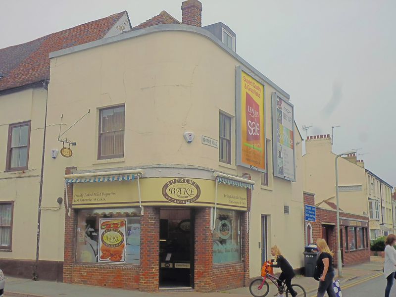
1.
944 ST DUNSTAN'S STREET
(North East Side)
No 29
TR 1458 SW 1/652
II GV
2.
A corner building. Late C18. 2 storeys stuccoed. Hipped tiled roof with
1 dormer. 3 sashes with verticals only. Modern shopfront. Included for
group value.
Nos 29 to 31 (consec) form a group.
Listing NGR: TR1438558273
External links are from the relevant listing authority and, where applicable, Wikidata. Wikidata IDs may be related buildings as well as this specific building. If you want to add or update a link, you will need to do so by editing the Wikidata entry.


Other nearby listed buildings
