Latitude: 51.2153 / 51°12'55"N
Longitude: -0.8003 / 0°48'1"W
OS Eastings: 483886
OS Northings: 146922
OS Grid: SU838469
Mapcode National: GBR DB3.NH4
Mapcode Global: VHDY2.2QR5
Plus Code: 9C3X658X+4V
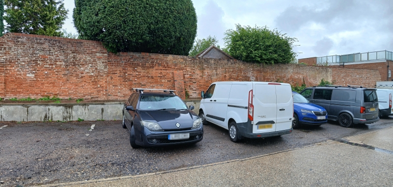
Entry Name: Rear Garden Wall to Numbers 6 and 7
Listing Date: 29 December 1972
Last Amended: 15 February 1974
Grade: II
Source: Historic England
Source ID: 1242286
English Heritage Legacy ID: 290847
ID on this website: 101242286
Location: Farnham, Waverley, Surrey, GU9
County: Surrey
District: Waverley
Civil Parish: Farnham
Built-Up Area: Farnham
Traditional County: Surrey
Lieutenancy Area (Ceremonial County): Surrey
Church of England Parish: Farnham
Church of England Diocese: Guildford
Tagged with: Architectural structure
1. 1099 CASTLE STREET (West side)
Rear garden wall to No 8 SU 8346 NE 5/7B
II
2. Cl9 probably. Red brick with red brick capping. Divided into bays by buttresses or pilasters.
All the listed buildings, with Nos 1 to 9 (consec) Lowndes Buildings, in Castle Street (West Side) form a group.
Listing NGR: SU8388646921
External links are from the relevant listing authority and, where applicable, Wikidata. Wikidata IDs may be related buildings as well as this specific building. If you want to add or update a link, you will need to do so by editing the Wikidata entry.


Other nearby listed buildings