Latitude: 53.355 / 53°21'18"N
Longitude: -3.0264 / 3°1'34"W
OS Eastings: 331781
OS Northings: 384727
OS Grid: SJ317847
Mapcode National: GBR 7Y9N.L1
Mapcode Global: WH87D.HX2V
Plus Code: 9C5R9X4F+2C
Entry Name: Royal Oak
Listing Date: 2 December 1986
Grade: II
Source: Historic England
Source ID: 1242376
English Heritage Legacy ID: 215602
ID on this website: 101242376
Location: Higher Bebington, Wirral, Merseyside, CH63
County: Wirral
Electoral Ward/Division: Bebington
Parish: Non Civil Parish
Built-Up Area: Bebington
Traditional County: Cheshire
Lieutenancy Area (Ceremonial County): Merseyside
Church of England Parish: Higher Bebington Christ Church
Church of England Diocese: Chester
In the entry for:
BEBINGTON VILLAGE ROAD 6/266 (north side) Higher Bebington Nos 18 to 22 (even) Royal Oak
The address shall be amended to read : No 22 Royal Oak
------------------------------------
BEBINGTON VILLAGE ROAD SJ 38 SW (north side) Higher Bebington 6/266 Nos. 18 to 22 (even) Royal Oak
II
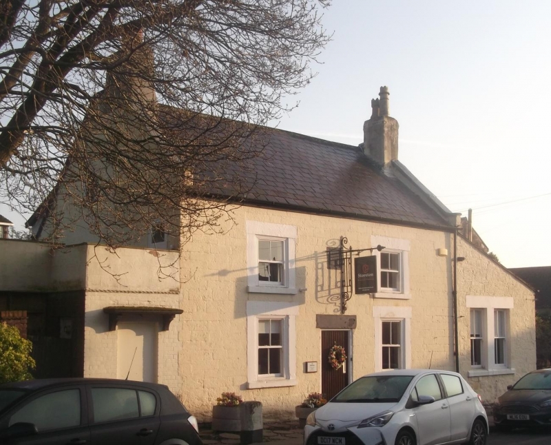
Public house, now architects' office. Datestone, "WTE/1739". Later lean-to extension. Stone with slate roof. 2 storeys, 2 bays. Windows have stone surrounds and are sashed with single glazing bars; lean-to bay has paired sashed windows. Entrance with plain lintel. Interior has some chamfered beams.
Listing NGR: SJ3178184727
External links are from the relevant listing authority and, where applicable, Wikidata. Wikidata IDs may be related buildings as well as this specific building. If you want to add or update a link, you will need to do so by editing the Wikidata entry.


Other nearby listed buildings