Approximate Location Map
Large Map »
Latitude: 52.164 / 52°9'50"N
Longitude: -2.0161 / 2°0'57"W
OS Eastings: 398997
OS Northings: 251753
OS Grid: SO989517
Mapcode National: GBR 2J4.73V
Mapcode Global: VHB0D.0VJX
Plus Code: 9C4V5X7M+JH
Entry Name: Church Farm
Listing Date: 3 August 1972
Grade: II
Source: Historic England
Source ID: 1242597
English Heritage Legacy ID: 442056
ID on this website: 101242597
Location: Bishampton, Wychavon, Worcestershire, WR10
County: Worcestershire
District: Wychavon
Civil Parish: Bishampton
Built-Up Area: Bishampton
Traditional County: Worcestershire
Lieutenancy Area (Ceremonial County): Worcestershire
Church of England Parish: Bishampton with Throckmorton
Church of England Diocese: Worcester
Tagged with: Agricultural structure
BISHAMPTON BISHAMPTON
1.
2301
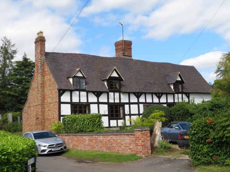
Church Farm
SO 95 SE 6/42
II
2.
Circa 1600. Timber frame front and painted brick with brackets below eaves.
One-storey plus attic. Long range with tile roof and gabled ends, 3 gabled
dormers. Modern casements. Later brick additions either side.
Listing NGR: SO9899751753
External links are from the relevant listing authority and, where applicable, Wikidata. Wikidata IDs may be related buildings as well as this specific building. If you want to add or update a link, you will need to do so by editing the Wikidata entry.


Other nearby listed buildings
