Approximate Location Map
Large Map »
Latitude: 51.2775 / 51°16'38"N
Longitude: 1.0759 / 1°4'33"E
OS Eastings: 614625
OS Northings: 157644
OS Grid: TR146576
Mapcode National: GBR TY2.W9F
Mapcode Global: VHLGM.L5N0
Plus Code: 9F3373GG+X9
Entry Name: 42A, Stour Street
Listing Date: 7 September 1973
Grade: II
Source: Historic England
Source ID: 1242651
English Heritage Legacy ID: 443439
ID on this website: 101242651
Location: Canterbury, Kent, CT1
County: Kent
District: Canterbury
Electoral Ward/Division: Westgate
Parish: Non Civil Parish
Built-Up Area: Canterbury
Traditional County: Kent
Lieutenancy Area (Ceremonial County): Kent
Tagged with: Building
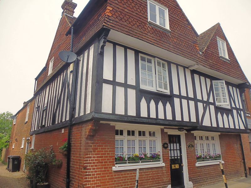
1.
944 STOUR STREET
(North West Side)
No 42A
TR 1457 NE 4/709
II GV
2.
C17 in origin but greatly restored. 3 storeys. Ground floor brick. 1st
floor is restored timber framing with plaster infill. 2nd floor is hung with
fishscale tiles. 2 gable fronts. Tiled roof. Casement windows. Restored
doorcases.
No 42A and Nos 44 to 47 (consec) form a group.
Listing NGR: TR1462057644
External links are from the relevant listing authority and, where applicable, Wikidata. Wikidata IDs may be related buildings as well as this specific building. If you want to add or update a link, you will need to do so by editing the Wikidata entry.


Other nearby listed buildings
