Approximate Location Map
Large Map »
Latitude: 52.1302 / 52°7'48"N
Longitude: -2.0215 / 2°1'17"W
OS Eastings: 398621
OS Northings: 247986
OS Grid: SO986479
Mapcode National: GBR 2JH.KQ3
Mapcode Global: VHB0K.XQ4C
Plus Code: 9C4V4XJH+39
Entry Name: Warrrens Cottage
Listing Date: 3 August 1972
Grade: II
Source: Historic England
Source ID: 1242695
English Heritage Legacy ID: 443541
ID on this website: 101242695
Location: Lower Moor, Wychavon, Worcestershire, WR10
County: Worcestershire
District: Wychavon
Civil Parish: Hill and Moor
Traditional County: Worcestershire
Lieutenancy Area (Ceremonial County): Worcestershire
Church of England Parish: Fladbury, Hill and Moor, Wyre Piddle, Cropthorne and Charlton
Church of England Diocese: Worcester
Tagged with: Cottage
HILL AND MOOR HILL
l.
2301
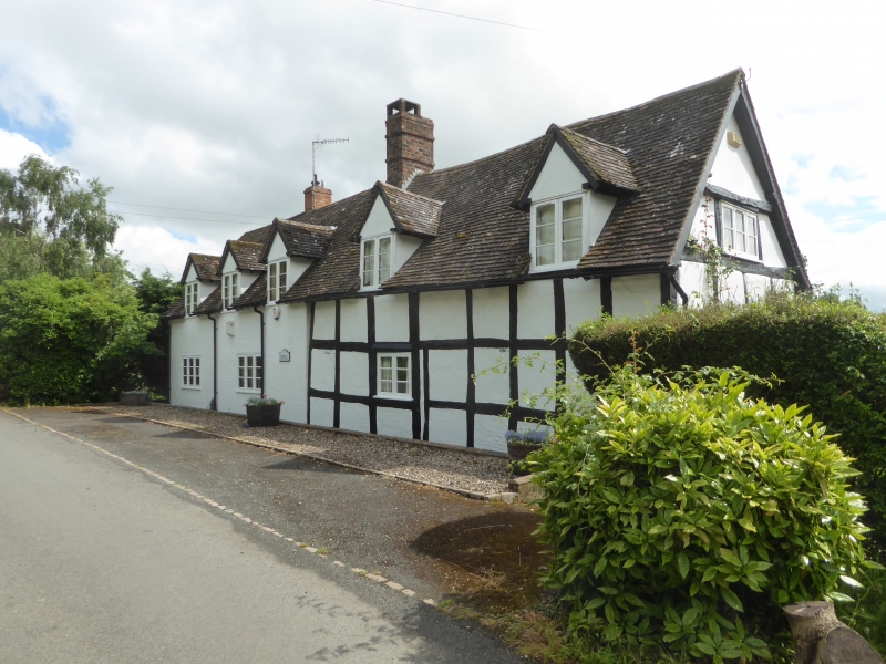
Warren's Cottage
SO 94 NE 10/483
II
2.
C17. Timber frame and plaster. Tiled roof with gabled dormers. Casements.
Weather hood over centre door,
Listing NGR: SO9862147986
External links are from the relevant listing authority and, where applicable, Wikidata. Wikidata IDs may be related buildings as well as this specific building. If you want to add or update a link, you will need to do so by editing the Wikidata entry.


Other nearby listed buildings
