Approximate Location Map
Large Map »
Latitude: 52.1259 / 52°7'33"N
Longitude: -2.0387 / 2°2'19"W
OS Eastings: 397448
OS Northings: 247507
OS Grid: SO974475
Mapcode National: GBR 2JH.MDN
Mapcode Global: VHB0K.MT2P
Plus Code: 9C4V4XG6+8G
Entry Name: Thatched Cottage
Listing Date: 3 August 1972
Grade: II
Source: Historic England
Source ID: 1242769
English Heritage Legacy ID: 443558
ID on this website: 101242769
Location: Upper Moor, Wychavon, Worcestershire, WR10
County: Worcestershire
District: Wychavon
Civil Parish: Hill and Moor
Traditional County: Worcestershire
Lieutenancy Area (Ceremonial County): Worcestershire
Church of England Parish: Fladbury, Hill and Moor, Wyre Piddle, Cropthorne and Charlton
Church of England Diocese: Worcester
Tagged with: Cottage Thatched cottage
HILL AND MOOR UPPER MOOR
1.
2301
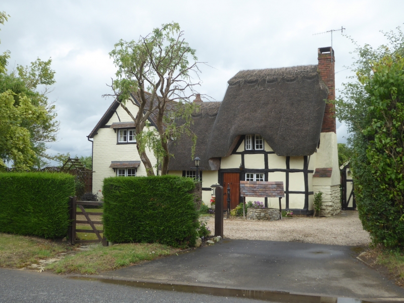
Thatched Cottage
SO 94 NE 10/499
II
2.
Small C17 cottage. Timber frame and whitened brick nogging. Casements.
Thatch roof with eyebrow dormer. Modern addition on left.
Listing NGR: SO9744847507
External links are from the relevant listing authority and, where applicable, Wikidata. Wikidata IDs may be related buildings as well as this specific building. If you want to add or update a link, you will need to do so by editing the Wikidata entry.


Other nearby listed buildings
