Latitude: 52.8193 / 52°49'9"N
Longitude: -2.0358 / 2°2'8"W
OS Eastings: 397684
OS Northings: 324642
OS Grid: SJ976246
Mapcode National: GBR 285.83K
Mapcode Global: WHBDV.PDSH
Plus Code: 9C4VRX97+PM
Entry Name: Old Stables at Ingestre Hall to South of the Church
Listing Date: 7 March 1953
Grade: II
Source: Historic England
Source ID: 1242959
English Heritage Legacy ID: 443941
ID on this website: 101242959
Location: Ingestre, Stafford, Staffordshire, ST18
County: Staffordshire
District: Stafford
Civil Parish: Ingestre
Traditional County: Staffordshire
Lieutenancy Area (Ceremonial County): Staffordshire
Church of England Parish: Ingestre St Mary the Virgin
Church of England Diocese: Lichfield
Tagged with: Architectural structure
INGESTRE
1.
2385
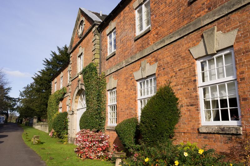
Old Stables at Ingestre Hall
SJ 92 SE 19/5A to South of the Church
7.3.53.
II
2.
Brick with stone rusticated quoins and tiled roofs; brick stacks; 2
storeys; casement windows; round headed archway on West (now blocked).
C18. Group value.
Listing NGR: SJ9768424642
External links are from the relevant listing authority and, where applicable, Wikidata. Wikidata IDs may be related buildings as well as this specific building. If you want to add or update a link, you will need to do so by editing the Wikidata entry.


Other nearby listed buildings