Latitude: 52.7992 / 52°47'57"N
Longitude: -2.306 / 2°18'21"W
OS Eastings: 379464
OS Northings: 322449
OS Grid: SJ794224
Mapcode National: GBR 05B.KSR
Mapcode Global: WH9CL.KW3Y
Plus Code: 9C4VQMXV+MH
Entry Name: Shropshire Union Canal, Canal Tunnel South of Norbury Junction
Listing Date: 15 January 1968
Grade: II
Source: Historic England
Source ID: 1242984
English Heritage Legacy ID: 443948
ID on this website: 101242984
Location: Norbury Junction, Stafford, Staffordshire, ST20
County: Staffordshire
District: Stafford
Civil Parish: Norbury
Traditional County: Staffordshire
Lieutenancy Area (Ceremonial County): Staffordshire
Church of England Parish: Norbury St Peter
Church of England Diocese: Lichfield
Tagged with: Architectural structure
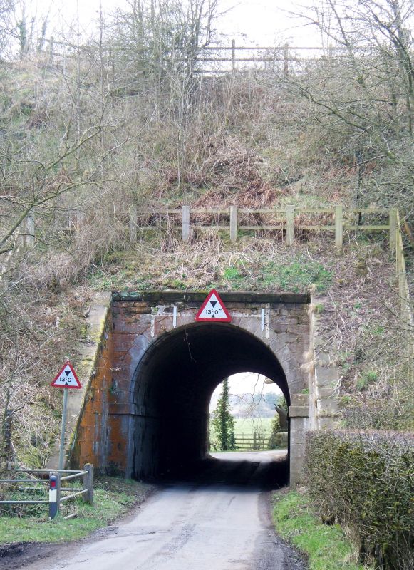
NORBURY
1.
2385
Canal Tunnel South of
Norbury Junction
SJ 72 SE 7/4 15.1.68.
II
2.
Probably late C18. Ashlar with barrel vault. Round headed arch at each end.
Listing NGR: SJ7946622448
External links are from the relevant listing authority and, where applicable, Wikidata. Wikidata IDs may be related buildings as well as this specific building. If you want to add or update a link, you will need to do so by editing the Wikidata entry.


Other nearby listed buildings