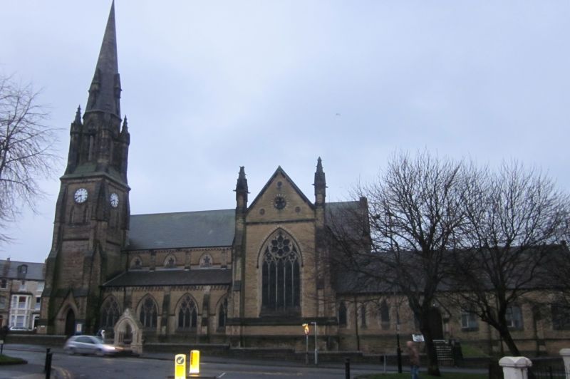
Latitude: 54.2749 / 54°16'29"N
Longitude: -0.4028 / 0°24'10"W
OS Eastings: 504100
OS Northings: 487761
OS Grid: TA041877
Mapcode National: GBR TMM0.LB
Mapcode Global: WHGC0.STC4
Plus Code: 9C6X7HFW+XV
Entry Name: Church of St Andrew (United Reformed)
Listing Date: 8 June 1973
Last Amended: 8 October 1993
Grade: II*
Source: Historic England
Source ID: 1243011
English Heritage Legacy ID: 446413
ID on this website: 101243011
Location: St Andrew's United Reformed Church, South Cliff, North Yorkshire, YO11
County: North Yorkshire
District: Scarborough
Electoral Ward/Division: Ramshill
Parish: Scarborough
Built-Up Area: Scarborough
Traditional County: Yorkshire
Lieutenancy Area (Ceremonial County): North Yorkshire
Church of England Parish: Scarborough St James
Church of England Diocese: York
Tagged with: Church building
RAMSHILL ROAD
Congregational Church 1605
TA 0487 6/315 II* (star)
The address shall be amended to read:- RAMSHILL ROAD
1605 St Andrews United Reformed Church
TA 0487 6/ 315 II* (star)
------------------------------------
RAMSHILL ROAD 1. 1605 Congregational Church TA 0487 6/315 II
The grade shall be amended to read II* (star).
------------------------------------
1. RAMSHILL ROAD 1605 Congregational Church TA 0487 6/315
II
2. Lockwood and Mawson architects. 1864-8. Eccentric C13 style stone built with tall south west steeple tower with unusual base to beginning of spire with much open work and colonetted arches.
Listing NGR: TA0410087761
External links are from the relevant listing authority and, where applicable, Wikidata. Wikidata IDs may be related buildings as well as this specific building. If you want to add or update a link, you will need to do so by editing the Wikidata entry.


Other nearby listed buildings