Approximate Location Map
Large Map »
Latitude: 51.0895 / 51°5'22"N
Longitude: -1.8116 / 1°48'41"W
OS Eastings: 413288
OS Northings: 132256
OS Grid: SU132322
Mapcode National: GBR 510.QSC
Mapcode Global: FRA 7637.L1P
Plus Code: 9C3W35QQ+Q8
Entry Name: Boundary Wall to East of Parsonage Farmhouse, Along Garden by Road
Listing Date: 12 October 1972
Grade: II
Source: Historic England
Source ID: 1243248
English Heritage Legacy ID: 446903
ID on this website: 101243248
Location: Stratford sub Castle, Wiltshire, SP1
County: Wiltshire
Civil Parish: Salisbury
Built-Up Area: Salisbury
Traditional County: Wiltshire
Lieutenancy Area (Ceremonial County): Wiltshire
Church of England Parish: Stratford sub Castle St Lawrence
Church of England Diocese: Salisbury
Tagged with: Wall
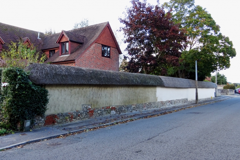
STRATFORD ROAD
1.
1594 Boundary wall to east of
Parsonage Farmhouse, along
garden by road
SU 1332 12/576C
II GV
2.
Thatched cob boundary wall now reduced with shell pattern.
-
Parsonage Farmhouse, walls and barn form a group.
Listing NGR: SU1328832256
External links are from the relevant listing authority and, where applicable, Wikidata. Wikidata IDs may be related buildings as well as this specific building. If you want to add or update a link, you will need to do so by editing the Wikidata entry.


Other nearby listed buildings
