Approximate Location Map
Large Map »
Latitude: 51.2902 / 51°17'24"N
Longitude: 0.2225 / 0°13'21"E
OS Eastings: 555070
OS Northings: 156903
OS Grid: TQ550569
Mapcode National: GBR VT.DRX
Mapcode Global: VHHPL.TT0V
Plus Code: 9F3276RF+32
Entry Name: Front Wall to the Vicarage
Listing Date: 16 January 1975
Grade: II
Source: Historic England
Source ID: 1243567
English Heritage Legacy ID: 447380
ID on this website: 101243567
Location: Seal, Sevenoaks, Kent, TN15
County: Kent
District: Sevenoaks
Civil Parish: Seal
Built-Up Area: Sevenoaks
Traditional County: Kent
Lieutenancy Area (Ceremonial County): Kent
Church of England Parish: Seal St Peter and St Paul
Church of England Diocese: Rochester
Tagged with: Wall
1.
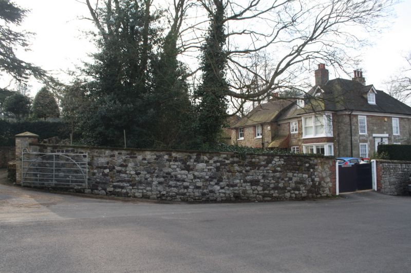
5280 SEAL SEAL
Church Street
(East Side)
Front wall to
The Vicarage
TQ 5556 NW 28/996
II
2.
C19 wall of random rubble with dressed stone coping.
Listing NGR: TQ5506956897
External links are from the relevant listing authority and, where applicable, Wikidata. Wikidata IDs may be related buildings as well as this specific building. If you want to add or update a link, you will need to do so by editing the Wikidata entry.


Other nearby listed buildings
