Latitude: 53.0004 / 53°0'1"N
Longitude: -0.8616 / 0°51'41"W
OS Eastings: 476498
OS Northings: 345396
OS Grid: SK764453
Mapcode National: GBR BL0.YT5
Mapcode Global: WHFHV.QVY5
Plus Code: 9C5X242Q+59
Entry Name: Pigeoncote
Listing Date: 1 December 1965
Last Amended: 14 November 1986
Grade: I
Source: Historic England
Source ID: 1243820
English Heritage Legacy ID: 448177
ID on this website: 101243820
Location: Sibthorpe, Rushcliffe, Nottinghamshire, NG23
County: Nottinghamshire
District: Rushcliffe
Civil Parish: Sibthorpe
Traditional County: Nottinghamshire
Lieutenancy Area (Ceremonial County): Nottinghamshire
Church of England Parish: Sibthorpe
Church of England Diocese: Southwell and Nottingham
Tagged with: Dovecote
SIBTHORPE off CHURCH LANE SK 74 NE (east side) 2/151 Pigeoncote (formerly listed as Dovecote in field east 1.12.65 of Church)
I
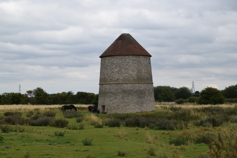
Pigeoncote. C14. Restored mid C20. Coursed rubble and dressed stone. Conical plain tile roof with square lead cap. Chamfered string course. Battered round tower, 2 stages. To north west, low doorway with timber lintel and stone jambs. Oak plank door.
Listing NGR: SK7649845396
External links are from the relevant listing authority and, where applicable, Wikidata. Wikidata IDs may be related buildings as well as this specific building. If you want to add or update a link, you will need to do so by editing the Wikidata entry.


Other nearby listed buildings