Approximate Location Map
Large Map »
Latitude: 51.3043 / 51°18'15"N
Longitude: 0.2281 / 0°13'41"E
OS Eastings: 555412
OS Northings: 158484
OS Grid: TQ554584
Mapcode National: GBR VS.N5V
Mapcode Global: VHHPL.WHY0
Plus Code: 9F32863H+P6
Entry Name: Barn to South West of Dyne's Farmhouse
Listing Date: 25 August 1987
Grade: II
Source: Historic England
Source ID: 1244193
English Heritage Legacy ID: 449053
ID on this website: 101244193
Location: Kemsing, Sevenoaks, Kent, TN15
County: Kent
District: Sevenoaks
Civil Parish: Kemsing
Built-Up Area: Otford
Traditional County: Kent
Lieutenancy Area (Ceremonial County): Kent
Church of England Parish: Kemsing St Mary the Virgin
Church of England Diocese: Rochester
Tagged with: Barn
KEMSING
TQ 5458 5558 ST EDITH'S ROAD
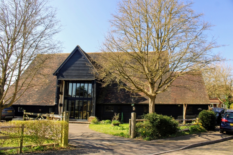
16/583 Barn to south west of
Dyne's Farmhouse
II
Barn. Late C17 or early C18 altered in early C19 when outshuts were added to east.
Partially weatherboarded with some tarred weatherboarding to east, west elevation
also weatherboarded but base of corrugated iron. South elevation has a deep stone
plinth and has red brick infilling to rear. Old tiled roof. Central gabled waggon
entrance to east flanked by early C19 outshuts to south having one sliding sash
and to north 2 sashes and a stable door, 5 bay barn. Angled queen strut roof with
3 tiers of through purlins with curved and diagonal tension braces. No ridge piece.
Gunstock jowled posts. Wall frames have curved tension braces. Waggon entrance
has reused beam from a house with diamond mortises.
Listing NGR: TQ5541258484
External links are from the relevant listing authority and, where applicable, Wikidata. Wikidata IDs may be related buildings as well as this specific building. If you want to add or update a link, you will need to do so by editing the Wikidata entry.


Other nearby listed buildings
