Latitude: 51.2536 / 51°15'12"N
Longitude: -0.942 / 0°56'31"W
OS Eastings: 473934
OS Northings: 151019
OS Grid: SU739510
Mapcode National: GBR C86.8PP
Mapcode Global: VHDXS.MRDD
Plus Code: 9C3X7335+C6
Entry Name: King's Barn
Listing Date: 8 July 1952
Grade: II*
Source: Historic England
Source ID: 1244231
English Heritage Legacy ID: 449147
ID on this website: 101244231
Location: Odiham, Hart, Hampshire, RG29
County: Hampshire
District: Hart
Civil Parish: Odiham
Built-Up Area: Odiham
Traditional County: Hampshire
Lieutenancy Area (Ceremonial County): Hampshire
Church of England Parish: Odiham All Saints
Church of England Diocese: Winchester
Tagged with: Architectural structure
SU 73-7450 & 73-7451 ODIHAM HIGH STREET (South Side)
17/54 No 129 (King's Barn) 8.7.52
GV II*
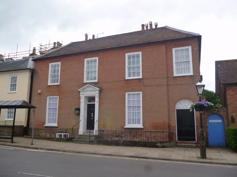
Circa 1780. Elegant facade (north) of 2 storeys, based on a symmetrical arrangement of 3 windows, but with a narrow 1 window addition to the west, set back slightly. Red tile hipped roof, moulded and bracketted brick eaves. Red brick walling in Flemish bond, with rubbed flat arches, stone cills, and high plinth. Sashes in exposed frames, with tall ground-floor windows (folding shutters within). Tall Adam-style doorcase, with 6-panelled door, panelled reveals, square fanlight with radiating pattern, panelled pilasters, moulded scroll brackets supporting an entablature with fluted frieze ornamented with roundels in the centre and over brackets, moulded and dentilled pediment, entablature broken forward over brackets, 5 stone steps. The west wing has an arched doorway with fanlight and 6 flush-panelled door, above steps.
Listing NGR: SU7393451014
External links are from the relevant listing authority and, where applicable, Wikidata. Wikidata IDs may be related buildings as well as this specific building. If you want to add or update a link, you will need to do so by editing the Wikidata entry.


Other nearby listed buildings