Latitude: 51.2533 / 51°15'11"N
Longitude: -0.9452 / 0°56'42"W
OS Eastings: 473707
OS Northings: 150985
OS Grid: SU737509
Mapcode National: GBR C86.7W8
Mapcode Global: VHDXS.KRNL
Plus Code: 9C3X7333+8W
Entry Name: 4, West Street
Listing Date: 26 June 1987
Grade: II
Source: Historic England
Source ID: 1244495
English Heritage Legacy ID: 449608
ID on this website: 101244495
Location: Odiham, Hart, Hampshire, RG29
County: Hampshire
District: Hart
Civil Parish: Odiham
Built-Up Area: Odiham
Traditional County: Hampshire
Lieutenancy Area (Ceremonial County): Hampshire
Church of England Parish: Odiham All Saints
Church of England Diocese: Winchester
Tagged with: Building
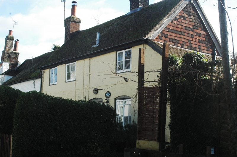
SU 73-7450 & 73-7451 ODIHAM WEST STREET
17/46 No 4
-
- II
Early C19, 2 storeys, 3 windows. Red tile roof. Painted brickwork (Flemish
bond), cambered openings. Casements. Weather boarded door in solid frame.
Modern single-storeyed outshot at west end. Included for landscape value.
Listing NGR: SU7372250986
External links are from the relevant listing authority and, where applicable, Wikidata. Wikidata IDs may be related buildings as well as this specific building. If you want to add or update a link, you will need to do so by editing the Wikidata entry.


Other nearby listed buildings