Latitude: 53.3542 / 53°21'14"N
Longitude: -1.4664 / 1°27'58"W
OS Eastings: 435616
OS Northings: 384273
OS Grid: SK356842
Mapcode National: GBR 9JW.4F
Mapcode Global: WHDDP.FYYJ
Plus Code: 9C5W9G3M+MF
Entry Name: Carfield Schools and Adjoining Playground Shelter
Listing Date: 12 December 1995
Grade: II
Source: Historic England
Source ID: 1246423
English Heritage Legacy ID: 455123
ID on this website: 101246423
Location: Meersbrook, Sheffield, South Yorkshire, S8
County: Sheffield
Electoral Ward/Division: Gleadless Valley
Parish: Non Civil Parish
Built-Up Area: Sheffield
Traditional County: Derbyshire
Lieutenancy Area (Ceremonial County): South Yorkshire
Church of England Parish: Norton Lees St Paul
Church of England Diocese: Sheffield
Tagged with: Architectural structure
SHEFFIELD
SK38SE ARGYLE ROAD 784-1/10/23 (South side) Carfield Schools and adjoining playground shelter
GV II
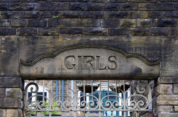
Formerly known as: Norton Lees School ARGYLE ROAD. Nursery, infant and junior schools and adjoining playground shelter. 1903 and c1913, with late C20 alterations. By Joseph Norton. For the Norton School Board. Coursed squared stone with ashlar dressings and gabled and hipped slate roofs. Renaissance Revival style. EXTERIOR: plinths, sillbands, string courses, coped gables and parapets. North front has to right the infant school, 2 storeys; 12 window range. Shouldered coped gables topped with segmental pediments, coped ridge stack and tapered octagonal wooden bell turret with ogee lead dome and finial. 4 shouldered through-eaves dormers with segmental pediments and glazing bar cross casements, each flanked by single smaller cross casements. Below, 6 large segment-headed 3-light windows, flanked to right by a segment-headed opening with infill panel and double board doors. To right again, a half-height segment-headed window. Beyond, blank rear wall to playground shelter. Left gable has a square projecting porch to left, flanked by a first-floor cross casement to its right. Below, a segment-headed opening with C20 doorway. Single storey rear elevation has a double gabled wing to left, with volutes, segmental pediments and pilasters. 6 tall cross casements, the right one altered to full height. To right, a shorter wing with coped gable stack and square projection with parapet. 5 wooden casements with transoms. Infant and junior school building, to left, 3 storeys; 12 window range. Double range plan. Shouldered coped gables with segmental pediments, crests and datestones, large ridge stack with arched opening, single side wall stack, and similar bell turret to the infant school. North front has 12 glazing bar cross casements and above, 4 through-eaves dormers with similar windows and segmental pediments, flanked by smaller cross casements. Below, 4 large segment-headed 3-light windows, flanked to right by 2 similar openings containing doors with overlights and sidelights, then 2 blocked half-height openings. Left end has projecting left gable with 2 doorways and overlights, flanked to right by a tall cross casement and an external dogleg stair to the lower yard, with coped balustrade walls. Above, 3 tall cross casements. Below, to right, a segment-headed opening with C20 doorway. Right end covered by scaffolding at time of survey. Rear elevation has a projecting double gabled wing, 2 storeys, with 6 tall cross casements on each floor. To left, a 2 storey set back bay with 2 windows on each floor, the upper ones larger. To right, a 3 storey set back bay with 3 small windows on each floor. To right again, a projecting hipped bay, 2 storeys, with 2 windows on each floor, the upper ones larger. Hipped link building and toilet block has blank north wall with external dogleg stair to right, with coped balustrade walls. Rear elevation has late C20 single storey additions. (Researches by G Hague, Sheffield City Council).
Listing NGR: SK3561684273
External links are from the relevant listing authority and, where applicable, Wikidata. Wikidata IDs may be related buildings as well as this specific building. If you want to add or update a link, you will need to do so by editing the Wikidata entry.


Other nearby listed buildings