Latitude: 53.4764 / 53°28'34"N
Longitude: -2.2384 / 2°14'18"W
OS Eastings: 384276
OS Northings: 397762
OS Grid: SJ842977
Mapcode National: GBR DLJ.0T
Mapcode Global: WHB9G.LWBB
Plus Code: 9C5VFQG6+GM
Entry Name: New Union Public House
Listing Date: 3 October 1974
Last Amended: 6 June 1994
Grade: II
Source: Historic England
Source ID: 1247444
English Heritage Legacy ID: 456843
Also known as: New Union
New Union, Manchester
ID on this website: 101247444
Location: City Centre, Manchester, Greater Manchester, M1
County: Manchester
Electoral Ward/Division: City Centre
Parish: Non Civil Parish
Built-Up Area: Manchester
Traditional County: Lancashire
Lieutenancy Area (Ceremonial County): Greater Manchester
Church of England Parish: Manchester St Ann
Church of England Diocese: Manchester
Tagged with: Pub
MANCHESTER
SJ8497NW PRINCESS STREET 698-1/32/344 (North East side) 03/10/74 No.111 New Union PH (Formerly Listed as: PRINCESS STREET (East side) Union Hotel)
GV II
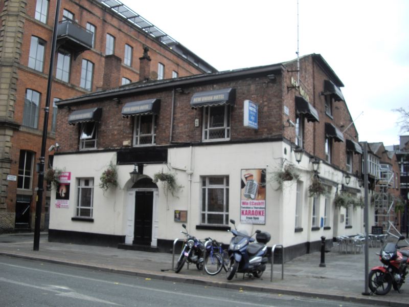
Public house. Early C19, altered. Red brick, with painted render to ground floor, slate roof. Rectangular plan on island site, at right-angles to street. Two storeys and 3 windows, symmetrical; plinth, 1st-floor sill-band; segmental-headed doorway with set-in doorcase and panelled door; altered casement windows on both floors; inn sign on bracket at right-hand end of 1st floor. Long and slightly concave right-hand return wall with similar openings; back extension. Interior altered, but contains some stained glass. Included for group value.
Listing NGR: SJ8427697762
External links are from the relevant listing authority and, where applicable, Wikidata. Wikidata IDs may be related buildings as well as this specific building. If you want to add or update a link, you will need to do so by editing the Wikidata entry.


Other nearby listed buildings