Latitude: 53.4817 / 53°28'54"N
Longitude: -2.2293 / 2°13'45"W
OS Eastings: 384880
OS Northings: 398354
OS Grid: SJ848983
Mapcode National: GBR DMG.ZX
Mapcode Global: WHB9G.QRM7
Plus Code: 9C5VFQJC+M7
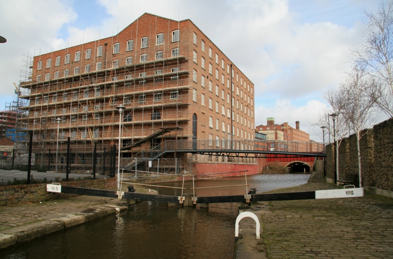
Entry Name: Rochdale Canal Lock Number 83, to the East of Tariff Street
Listing Date: 6 June 1994
Grade: II
Source: Historic England
Source ID: 1247479
English Heritage Legacy ID: 456975
ID on this website: 101247479
Location: Ancoats, Manchester, Greater Manchester, M1
County: Manchester
Electoral Ward/Division: Ancoats and Clayton
Parish: Non Civil Parish
Built-Up Area: Manchester
Traditional County: Lancashire
Lieutenancy Area (Ceremonial County): Greater Manchester
Church of England Parish: Manchester St Ann
Church of England Diocese: Manchester
Tagged with: Lock
MANCHESTER
SJ8498SE ROCHDALE CANAL 698-1/29/354 Lock No.83, to east of Tariff Street
GV II
Canal lock. c.1800, for Rochdale Canal Company; now disused. Coursed squared sandstone, wooden gates. Chamber of 14-foot width with pairs of gates, ladder in centre of north side. Forms group with Brownfield Mill, Binns Place (q.v.), and towpath ramp opposite this (q.v.).
Listing NGR: SJ8488098353
External links are from the relevant listing authority and, where applicable, Wikidata. Wikidata IDs may be related buildings as well as this specific building. If you want to add or update a link, you will need to do so by editing the Wikidata entry.


Other nearby listed buildings