Latitude: 53.4744 / 53°28'27"N
Longitude: -2.2458 / 2°14'45"W
OS Eastings: 383779
OS Northings: 397543
OS Grid: SJ837975
Mapcode National: GBR DJK.DJ
Mapcode Global: WHB9G.GXSV
Plus Code: 9C5VFQF3+PM
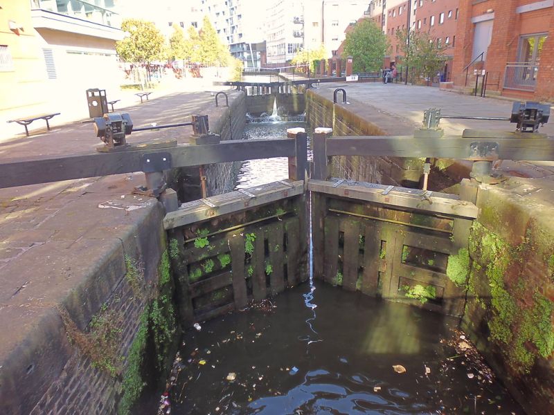
Entry Name: Rochdale Canal Lock Number 89 (Tib Lock), on South Side of Havelock Mills
Listing Date: 6 June 1994
Grade: II
Source: Historic England
Source ID: 1247596
English Heritage Legacy ID: 456981
Also known as: Tib Lock
Lock 89, Rochdale Canal
ID on this website: 101247596
Location: Manchester, Greater Manchester, M1
County: Manchester
Electoral Ward/Division: City Centre
Parish: Non Civil Parish
Built-Up Area: Manchester
Traditional County: Lancashire
Lieutenancy Area (Ceremonial County): Greater Manchester
Church of England Parish: Manchester St Ann
Church of England Diocese: Manchester
Tagged with: Lock
MANCHESTER
SJ8397NE ROCHDALE CANAL 698-1/31/360 Lock No.89 (Tib Lock), on south side of Havelock Mills
GV II
Canal lock. 1804-5, for Rochdale Canal Company; restored. Coursed squared sandstone, wooden gates. Chamber of 14-foot width with pairs of gates at both ends, ladder in centre of north side. Sixth in series of 9 locks on extension linking former Rochdale Canal basin at Dale Street with Bridgewater Canal basin at Castlefield, all in working order. Forms part of group with Havelock Mills (72-76 Great Bridgewater Street, q.v.) and with Albion Street Bridge to west (q.v.).
Listing NGR: SJ8377997543
External links are from the relevant listing authority and, where applicable, Wikidata. Wikidata IDs may be related buildings as well as this specific building. If you want to add or update a link, you will need to do so by editing the Wikidata entry.


Other nearby listed buildings