Latitude: 53.769 / 53°46'8"N
Longitude: -1.4174 / 1°25'2"W
OS Eastings: 438498
OS Northings: 430451
OS Grid: SE384304
Mapcode National: GBR LSJV.YN
Mapcode Global: WHDBS.6J9G
Plus Code: 9C5WQH9M+H2
Entry Name: Sundial Approximately 10 Metres South of Church of St Mary
Listing Date: 15 September 1987
Grade: II
Source: Historic England
Source ID: 1247735
English Heritage Legacy ID: 429023
ID on this website: 101247735
Location: St Mary's Parish Church, Swillington, Leeds, West Yorkshire, LS26
County: Leeds
Civil Parish: Swillington
Built-Up Area: Swillington
Traditional County: Yorkshire
Lieutenancy Area (Ceremonial County): West Yorkshire
Church of England Parish: Swillington St Mary
Church of England Diocese: Leeds
Tagged with: Sundial
SE 33 SE SWILLINGTON CHURCH LANE
LS26 (north side)
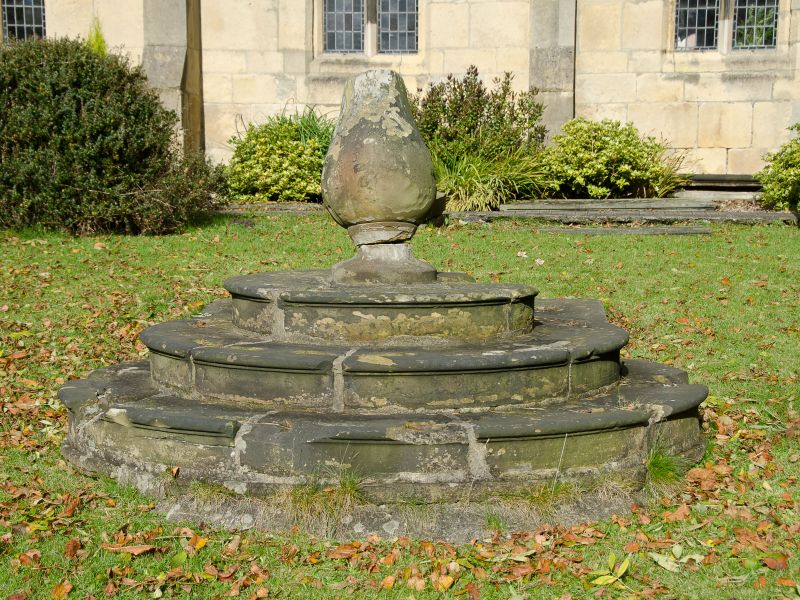
2/49 Sundial
approx. 10 metres
south of
Church of St. Mary
GV II
Sundial. Probably C18. Stone. Base of 3 circular steps, vase pedestal,
brass plate and gnomon (lettering on plate illegible).
Listing NGR: SE3849830451
External links are from the relevant listing authority and, where applicable, Wikidata. Wikidata IDs may be related buildings as well as this specific building. If you want to add or update a link, you will need to do so by editing the Wikidata entry.


Other nearby listed buildings