Approximate Location Map
Large Map »
Latitude: 53.1273 / 53°7'38"N
Longitude: -1.54 / 1°32'23"W
OS Eastings: 430880
OS Northings: 359003
OS Grid: SK308590
Mapcode National: GBR 6B8.TQW
Mapcode Global: WHCDP.9NYD
Plus Code: 9C5W4FG6+W2
Entry Name: Barn of Riber Hall
Listing Date: 26 October 1972
Grade: II
Source: Historic England
Source ID: 1248181
English Heritage Legacy ID: 429655
ID on this website: 101248181
Location: Riber, Derbyshire Dales, Derbyshire, DE4
County: Derbyshire
District: Derbyshire Dales
Civil Parish: Matlock Town
Traditional County: Derbyshire
Lieutenancy Area (Ceremonial County): Derbyshire
Church of England Parish: Tansley Holy Trinity
Church of England Diocese: Derby
Tagged with: Barn
1. RISER
1390
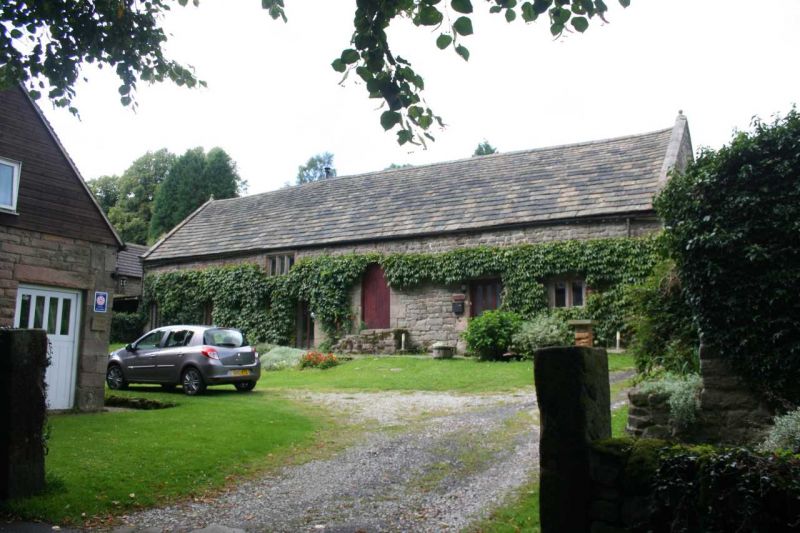
Barn of Riber Hall
SK 3059 5/45
SK 35 W 7/45
II
2.
Cl7. Stone. A long single-storeyed range with plain lights and chamfered
square-headed entrances; stone gabled ends; generally old stone tiles,
some asbestos sheeting and slates.
Listing NGR: SK3088059002
External links are from the relevant listing authority and, where applicable, Wikidata. Wikidata IDs may be related buildings as well as this specific building. If you want to add or update a link, you will need to do so by editing the Wikidata entry.


Other nearby listed buildings
