Latitude: 54.9432 / 54°56'35"N
Longitude: -1.603 / 1°36'10"W
OS Eastings: 425530
OS Northings: 561023
OS Grid: NZ255610
Mapcode National: GBR KC78.RS
Mapcode Global: WHC3Y.B0XS
Plus Code: 9C6WW9VW+7R
Entry Name: Aviaries to North East of Saltwell Towers
Listing Date: 23 January 1973
Grade: II
Source: Historic England
Source ID: 1248554
English Heritage Legacy ID: 430215
ID on this website: 101248554
Location: Draughts' Garden, Saltwell, Gateshead, Tyne and Wear, NE9
County: Gateshead
Electoral Ward/Division: Saltwell
Parish: Non Civil Parish
Built-Up Area: Gateshead
Traditional County: Durham
Lieutenancy Area (Ceremonial County): Tyne and Wear
Church of England Parish: Gateshead St Helen
Church of England Diocese: Durham
Tagged with: Architectural structure
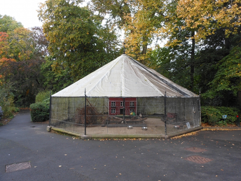
1. EAST PARK ROAD
5099 (west side)
NZ 2561 9/83 Aviaries to north-east
of Saltwell Towers
II GV
2.
Circa 1800. Two octagonal buildings. Stone and wrought iron. Coursed squared
stone bases, framed upper parts rising to pointed roofs.
Listing NGR: NZ2553061023
External links are from the relevant listing authority and, where applicable, Wikidata. Wikidata IDs may be related buildings as well as this specific building. If you want to add or update a link, you will need to do so by editing the Wikidata entry.


Other nearby listed buildings