Approximate Location Map
Large Map »
Latitude: 51.1238 / 51°7'25"N
Longitude: -0.0076 / 0°0'27"W
OS Eastings: 539526
OS Northings: 137944
OS Grid: TQ395379
Mapcode National: GBR KLY.JVT
Mapcode Global: VHGSZ.T0BT
Plus Code: 9C3X4XFR+GX
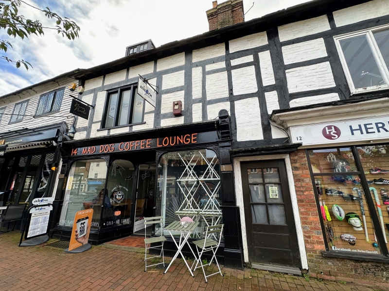
Entry Name: 10-14, High Street
Listing Date: 2 August 1972
Grade: II
Source: Historic England
Source ID: 1248794
English Heritage Legacy ID: 430531
ID on this website: 101248794
Location: East Grinstead, Mid Sussex, RH19
County: West Sussex
District: Mid Sussex
Civil Parish: East Grinstead
Built-Up Area: East Grinstead
Traditional County: Sussex
Lieutenancy Area (Ceremonial County): West Sussex
Church of England Parish: East Grinstead St Swithun
Church of England Diocese: Chichester
Tagged with: Building
1.
1068 HIGH STREET
(South Side)
Nos 10 to 14 (even)
TQ 3937 1/27
II
2.
One storey over shop. Exposed timber frame and brick nogging - both painted,
black and white. C19 wood casements. Two moulded door hoods. Three simple
dormers. Horsham slab roof.
Listing NGR: TQ3951937942
External links are from the relevant listing authority and, where applicable, Wikidata. Wikidata IDs may be related buildings as well as this specific building. If you want to add or update a link, you will need to do so by editing the Wikidata entry.


Other nearby listed buildings
