Approximate Location Map
Large Map »
Latitude: 53.908 / 53°54'28"N
Longitude: -0.1718 / 0°10'18"W
OS Eastings: 520194
OS Northings: 447311
OS Grid: TA201473
Mapcode National: GBR WR77.LT
Mapcode Global: WHHG6.B1FC
Plus Code: 9C5XWR5H+67
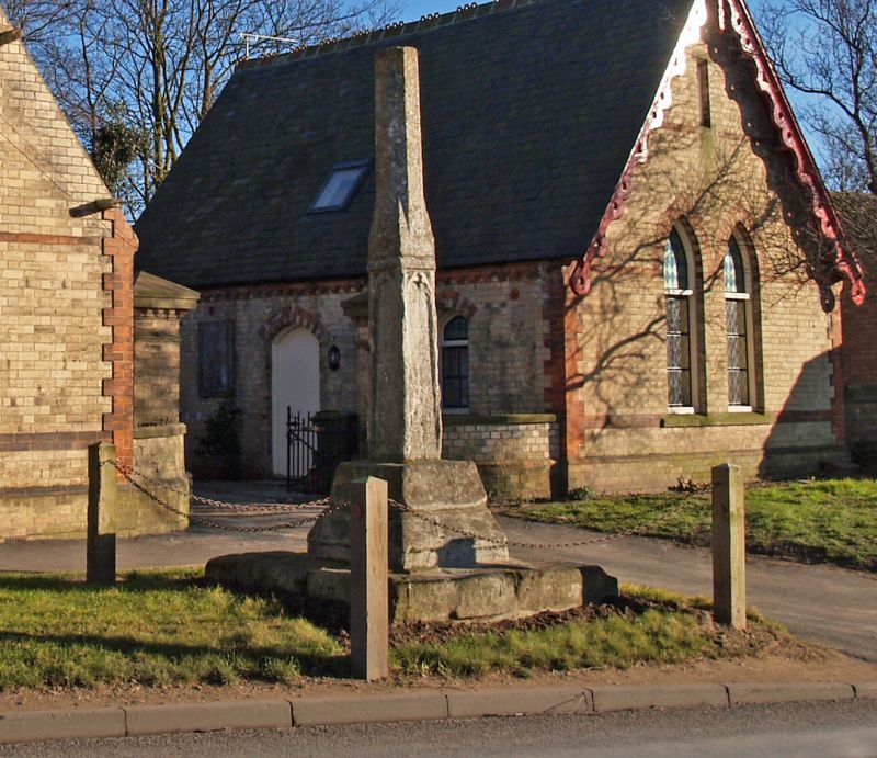
Entry Name: Wayside Cross
Listing Date: 26 November 1985
Grade: II
Source: Historic England
Source ID: 1249393
English Heritage Legacy ID: 431507
ID on this website: 101249393
Location: Hornsea, East Riding of Yorkshire, HU18
County: East Riding of Yorkshire
Civil Parish: Hornsea
Built-Up Area: Hornsea
Traditional County: Yorkshire
Lieutenancy Area (Ceremonial County): East Riding of Yorkshire
Church of England Parish: Hornsea St Nicholas
Church of England Diocese: York
Tagged with: Wayside cross
TA 24 NW HORNSEA SOUTHGATE
(east side)
11/44 Wayside Cross
- II
Cross. Probably C14. White limestone. Stepped and chamfered base,
supporting shaft: lower portion 4-sided with trefoiled blank panels; upper
portion tapering, eight-sided, with broach stops.
Listing NGR: TA2019447311
External links are from the relevant listing authority and, where applicable, Wikidata. Wikidata IDs may be related buildings as well as this specific building. If you want to add or update a link, you will need to do so by editing the Wikidata entry.


Other nearby listed buildings
