Latitude: 51.1516 / 51°9'5"N
Longitude: 0.3983 / 0°23'53"E
OS Eastings: 567830
OS Northings: 141888
OS Grid: TQ678418
Mapcode National: GBR NR2.RJ6
Mapcode Global: VHJMX.VBF0
Plus Code: 9F32592X+M8
Entry Name: The Cottage South East of Portobello Including Walls to the Garden East of Portobello
Listing Date: 24 August 1990
Grade: II
Source: Historic England
Source ID: 1249605
English Heritage Legacy ID: 431800
ID on this website: 101249605
Location: Brenchley, Tunbridge Wells, Kent, TN12
County: Kent
District: Tunbridge Wells
Civil Parish: Brenchley
Built-Up Area: Brenchley
Traditional County: Kent
Lieutenancy Area (Ceremonial County): Kent
Church of England Parish: Brenchley All Saints
Church of England Diocese: Rochester
Tagged with: Cottage
TQ 67 41 BRENCHLEY HIGH STREET, BRENCHLEY (north side) 15/90 The Cottage south east of Portobello including walls to the garden east of Portobello GV II
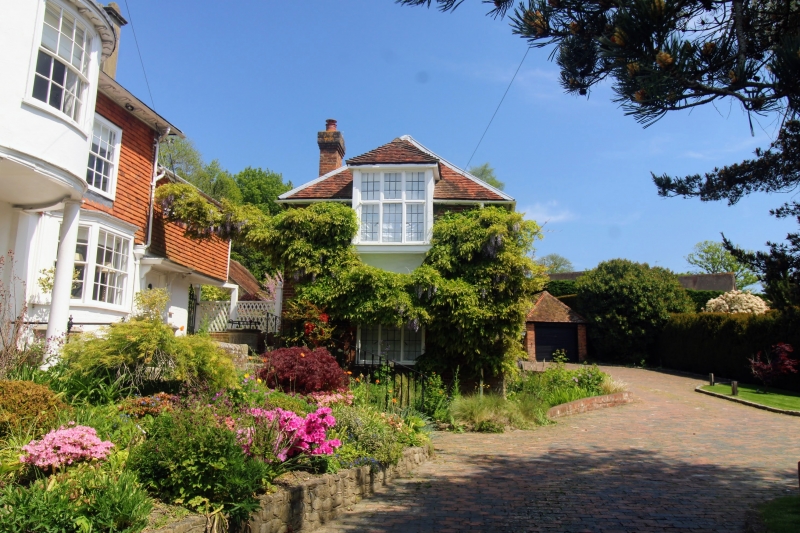
Cottage and garden walls, the cottage converted in 1934 for Robert Bradley from the C18 or early C19 stable block to Portobello (q.v.). Flemish bond brick, the cottage roofed with peg-tiles with lead rolls; 1930s brick stacks.
Plan: The Cottage is sited south east of Portobello and roofed on a west east axis. Walls to the garden at the rear (east) of the house link the barn (q.v.) with the Cottage. Although the 1930s conversion was drastic the former stable is still important as part of the context of a good C18 gentry house. The existing plan form preserves the former loft access to the stable on the north side, facing Portobello.
Exterior: 2 storeys cottage with a hipped roof and original moulded eaves cornice. The south elevation is 4 windows with a front door with gabled porch to right of centre; 2- and 3-light casements with square leaded panes date from the conversion, with one ground floor oriel. The west elevation, facing the road, has a first floor coved oriel of 1934 with a transomed window and a 3-light ground floor window with a segmental arched head, both glazed with square leaded panes. The north elevation has various C20 casements and a flight of external steps to the west leading to a former loft doorway. The garden walls include an archway adjacent to the barn.
Group value with Portobello.
A copy of an elevation of the house, dated 1826 and signed by John Adams, surveyor, of Tenterden, is in the possession of the owner. This shows the stable block and all its original openings on the south side.
Listing NGR: TQ6783041888
External links are from the relevant listing authority and, where applicable, Wikidata. Wikidata IDs may be related buildings as well as this specific building. If you want to add or update a link, you will need to do so by editing the Wikidata entry.


Other nearby listed buildings