Latitude: 51.27 / 51°16'11"N
Longitude: 1.3421 / 1°20'31"E
OS Eastings: 633227
OS Northings: 157622
OS Grid: TR332576
Mapcode National: GBR X18.B52
Mapcode Global: VHLGS.6BWR
Plus Code: 9F33789R+XV
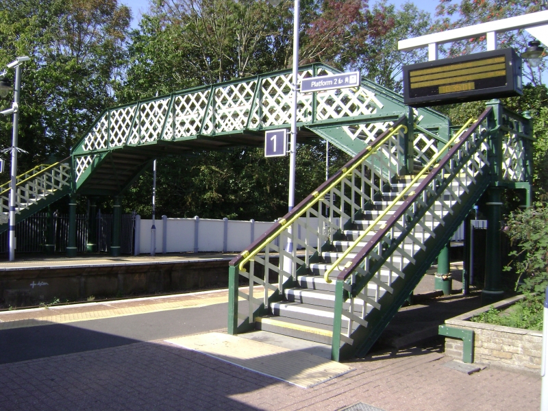
Entry Name: Footbridge at Sandwich Railway Station
Listing Date: 19 October 1995
Grade: II
Source: Historic England
Source ID: 1249732
English Heritage Legacy ID: 431936
ID on this website: 101249732
Location: Sandwich, Dover, Kent, CT13
County: Kent
District: Dover
Civil Parish: Sandwich
Built-Up Area: Sandwich
Traditional County: Kent
Lieutenancy Area (Ceremonial County): Kent
Tagged with: Railway footbridge
TR 3357 NW SANDWICH DOVER ROAD (off)
2/10002 Footbridge at Sandwich Railway Station
GV II
Passenger footbridge. 1847 for South Eastern Railway. Cast iron structure supported on 8 Tuscan columns with criss-cross panelling to the balustrades.
Listing NGR: TR3322757622
External links are from the relevant listing authority and, where applicable, Wikidata. Wikidata IDs may be related buildings as well as this specific building. If you want to add or update a link, you will need to do so by editing the Wikidata entry.


Other nearby listed buildings