Latitude: 52.3892 / 52°23'21"N
Longitude: -1.2617 / 1°15'42"W
OS Eastings: 450338
OS Northings: 277055
OS Grid: SP503770
Mapcode National: GBR 7P1.5T5
Mapcode Global: VHCTR.26TR
Plus Code: 9C4W9PQQ+M8
Entry Name: Rugby Aqueduct
Listing Date: 19 November 1992
Grade: II
Source: Historic England
Source ID: 1249970
English Heritage Legacy ID: 432184
ID on this website: 101249970
Location: Rugby, Warwickshire, CV21
County: Warwickshire
District: Rugby
Electoral Ward/Division: Newbold and Brownsover
Parish: Non Civil Parish
Built-Up Area: Rugby
Traditional County: Warwickshire
Lieutenancy Area (Ceremonial County): Warwickshire
Church of England Parish: Newbold-on-Avon St Botolph
Church of England Diocese: Coventry
Tagged with: Aqueduct
RUGBY OXFORD CANAL SP 57 NW 9/10003 Rugby aqueduct, shown on OS map as Browns over Aqueduct - II
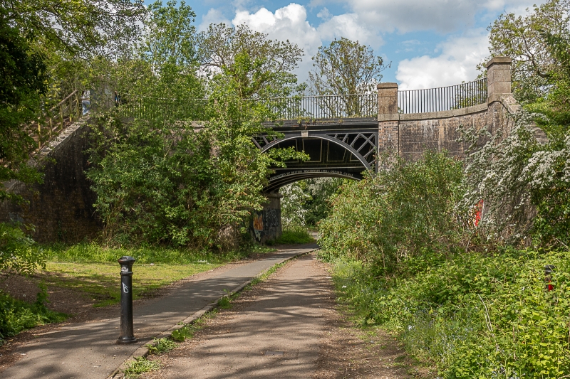
Aqueduct. 1831-34, repaired and refurbished 1991. Single span across road. Cast-iron trough constructed of bolted planks, slung between semi-circular, openwork metal girders supporting towpath and offside Moulded iron cornices. Solid brick abutments and outward-curving wing walls with stone mouldings and copings. Brick pilasters rising to parapet height and finished in stone, at four corners of trough and at terminations of wings. Parapets are square section metal railings with partly flat and partly moulded top rails. Constructed during improvements to Oxford canal carried out with William Cubitt as consulting engineer.
Listing NGR: SP5048977480
External links are from the relevant listing authority and, where applicable, Wikidata. Wikidata IDs may be related buildings as well as this specific building. If you want to add or update a link, you will need to do so by editing the Wikidata entry.


Other nearby listed buildings