Latitude: 52.3732 / 52°22'23"N
Longitude: -1.2608 / 1°15'38"W
OS Eastings: 450424
OS Northings: 275269
OS Grid: SP504752
Mapcode National: GBR 8QL.626
Mapcode Global: VHCTR.3MB3
Plus Code: 9C4W9PFQ+7M
Entry Name: Lloyds Bank
Listing Date: 12 November 1990
Grade: II
Source: Historic England
Source ID: 1249998
English Heritage Legacy ID: 432228
ID on this website: 101249998
Location: Rugby, Warwickshire, CV21
County: Warwickshire
District: Rugby
Electoral Ward/Division: Benn
Parish: Non Civil Parish
Built-Up Area: Rugby
Traditional County: Warwickshire
Lieutenancy Area (Ceremonial County): Warwickshire
Church of England Parish: Rugby St Andrew
Church of England Diocese: Coventry
Tagged with: Bank building
The following buildings shall be included:
RUGBY CHURCH STREET SP 5075 SW 1/61 No 14 (Lloyds Bank)
II GV
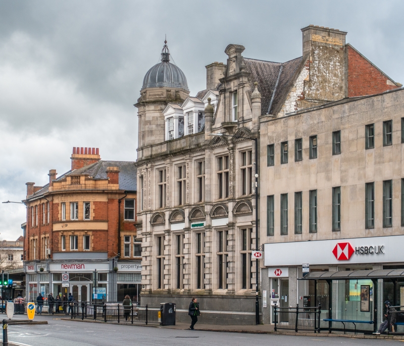
Bank. Dated 1904, extended in late C20. Portland stone. Slate roofs. Plan: corner site with entrance on corner into banking hall which occupies most of the ground floor. North wing facing Regent Street extended later in C20. Edwardian Baroque. Two storeys and attic. Asymmetrical elevations. Tall ground floor with rusticated pilasters and Gibbs surround to round arch entrance in splayed corner, with oriel above on first floor, surmounted by octagonal corner turret with pairs of Tuscan columns alternating with round arch windows and with dome above. Right hand (south) elevation 3:2 bays; left hand (west) elevation 1:2 bays, the end bays of both elevations have elaborate Dutch gables with octagonal turrets, the west elevation with large first floor oriel. Stone cross-mullion transom windows with ornate pilasters between on the first floor and modillion cornice, parapet and pilastered rind pedimented wooden dormers above. The aedicules at the top of the end gables have small carved panels depicting bee skeps. The west wing has shield with dates 1765 and 1904; extended on left in later C20.
Listing NGR: SP5042475269
External links are from the relevant listing authority and, where applicable, Wikidata. Wikidata IDs may be related buildings as well as this specific building. If you want to add or update a link, you will need to do so by editing the Wikidata entry.


Other nearby listed buildings