Latitude: 51.2228 / 51°13'22"N
Longitude: 1.404 / 1°24'14"E
OS Eastings: 637783
OS Northings: 152573
OS Grid: TR377525
Mapcode National: GBR X1Y.7SK
Mapcode Global: VHMDG.9J2G
Plus Code: 9F336CF3+4H
Entry Name: Killowen
Listing Date: 8 February 1974
Grade: II
Source: Historic England
Source ID: 1250316
English Heritage Legacy ID: 176942
ID on this website: 101250316
Location: Deal, Dover, Kent, CT14
County: Kent
District: Dover
Civil Parish: Deal
Built-Up Area: Deal
Traditional County: Kent
Lieutenancy Area (Ceremonial County): Kent
Tagged with: Building
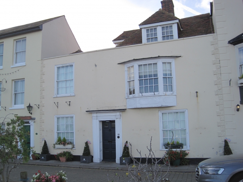
BEACH STREET
1.
1035
(West Side)
No 15
(Killowen)
TR 3752 NE 1/9
II GV
2.
C18. 2 storeys and attic stuccoed. Hipped tiled roof with a hipped slate portion
to the extreme left. Parapet. Long and short quoins. 2 sashes and 1 large
bay window on 1st floor. Doorcase with pilasters and entablature, panelled reveals
and 8 panelled doors, 2 of the panels cut away and glazed.
Nos 1 to 19 (odd) form a group.
Listing NGR: TR3778352573
External links are from the relevant listing authority and, where applicable, Wikidata. Wikidata IDs may be related buildings as well as this specific building. If you want to add or update a link, you will need to do so by editing the Wikidata entry.


Other nearby listed buildings