Approximate Location Map
Large Map »
Latitude: 50.8089 / 50°48'31"N
Longitude: -2.0353 / 2°2'7"W
OS Eastings: 397608
OS Northings: 101035
OS Grid: ST976010
Mapcode National: GBR 31K.87R
Mapcode Global: FRA 66MY.NX3
Plus Code: 9C2VRX57+GV
Entry Name: Obelisk 330 Metres South West of Kingston Lacy House
Listing Date: 2 November 1982
Grade: II
Source: Historic England
Source ID: 1250331
English Heritage Legacy ID: 432631
ID on this website: 101250331
Location: Dorset, BH21
County: Dorset
Civil Parish: Pamphill
Traditional County: Dorset
Lieutenancy Area (Ceremonial County): Dorset
Church of England Parish: Kingston Lacy St Stephen
Church of England Diocese: Salisbury
Tagged with: Obelisk
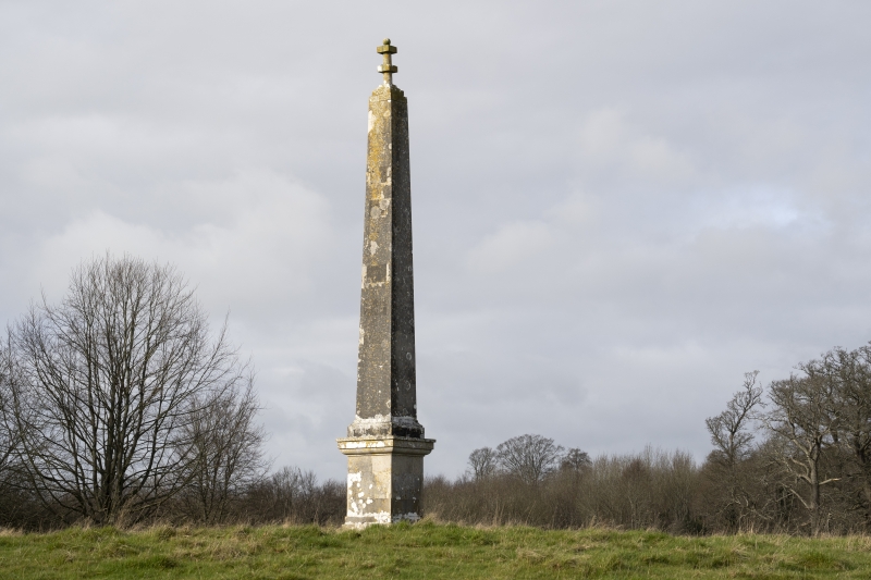
1.
5193 PAMPHILL
Obelisk 330 m south-west of
Kingston Lacey House
ST 90 SE 3/13 2.11.82
II
2.
Probably C18. Square tapering obelisk on plinth with moulded cap and base.
Cap to obelisk stepped back, and surmounted by a short circular column
encircled by two square "rings". No inscription.
Listing NGR: ST9760801035
External links are from the relevant listing authority and, where applicable, Wikidata. Wikidata IDs may be related buildings as well as this specific building. If you want to add or update a link, you will need to do so by editing the Wikidata entry.


Other nearby listed buildings
