Latitude: 51.2408 / 51°14'26"N
Longitude: 0.5171 / 0°31'1"E
OS Eastings: 575800
OS Northings: 152075
OS Grid: TQ758520
Mapcode National: GBR PRL.5K8
Mapcode Global: VHJML.X28N
Plus Code: 9F326GR8+8V
Entry Name: Barn About 11 Metres North North West of Brook House
Listing Date: 26 February 1987
Grade: II
Source: Historic England
Source ID: 1250594
English Heritage Legacy ID: 433029
ID on this website: 101250594
Location: Loose, Maidstone, Kent, ME15
County: Kent
District: Maidstone
Civil Parish: Loose
Built-Up Area: Maidstone
Traditional County: Kent
Lieutenancy Area (Ceremonial County): Kent
Tagged with: Barn
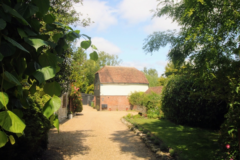
OLD LOOSE HILL TQ 7552 LOOSE (West Side) 6/196 Barn about 11 metres north-north- west of Brook House GV II Barn. Late C18. Ground floor red and grey brick in Flemish bond, first floor rendered to sides, weatherbaorded to gable ends. Plain tile roof. 2 storeys. Half-hipped roof. No windows to front or rear elevations. Round-headed sash window to first floor of north gable end. Louvred Diocletian window to centre of ground floor below, flanked by two blind segmental-headed recesses. 3 small first- floor sashes to south gable end and garage doors to ground floor. Interior not inspected.
Listing NGR: TQ7580052075
External links are from the relevant listing authority and, where applicable, Wikidata. Wikidata IDs may be related buildings as well as this specific building. If you want to add or update a link, you will need to do so by editing the Wikidata entry.


Other nearby listed buildings