Approximate Location Map
Large Map »
Latitude: 50.8118 / 50°48'42"N
Longitude: -0.3695 / 0°22'10"W
OS Eastings: 514967
OS Northings: 102623
OS Grid: TQ149026
Mapcode National: GBR HMP.3D6
Mapcode Global: FRA B63Y.HVT
Plus Code: 9C2XRJ6J+P5
Entry Name: 5, Warwick Street
Listing Date: 21 May 1976
Grade: II
Source: Historic England
Source ID: 1250691
English Heritage Legacy ID: 433149
ID on this website: 101250691
Location: Worthing, West Sussex, BN11
County: West Sussex
District: Worthing
Electoral Ward/Division: Central
Parish: Non Civil Parish
Built-Up Area: Worthing
Traditional County: Sussex
Lieutenancy Area (Ceremonial County): West Sussex
Church of England Parish: Worthing Holy Trinity with Christ Church
Church of England Diocese: Chichester
Tagged with: Building
TQ 1402 NE 3/29
5406
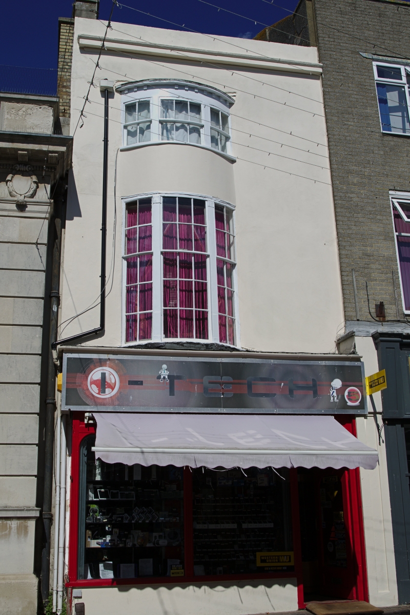
WARWICK STREET (North Side),
No 5
II
Early C19. 3 storeys. 1 window. Stuccoed. Cornice and parapet. Bow window
of 3 lights with its own cornice and modillions. Modern shop front.
Listing NGR: TQ1496702623
External links are from the relevant listing authority and, where applicable, Wikidata. Wikidata IDs may be related buildings as well as this specific building. If you want to add or update a link, you will need to do so by editing the Wikidata entry.


Other nearby listed buildings
