Latitude: 54.7151 / 54°42'54"N
Longitude: -1.238 / 1°14'16"W
OS Eastings: 449187
OS Northings: 535833
OS Grid: NZ491358
Mapcode National: GBR MFSX.SK
Mapcode Global: WHD66.YRN6
Plus Code: 9C6WPQ86+2R
Entry Name: Tunnel Under Railway Embankment
Listing Date: 2 August 1990
Grade: II
Source: Historic England
Source ID: 1250860
English Heritage Legacy ID: 433353
ID on this website: 101250860
Location: West View, Hartlepool, County Durham, TS24
County: Hartlepool
Electoral Ward/Division: De Bruce
Parish: Non Civil Parish
Built-Up Area: Hartlepool
Traditional County: Durham
Lieutenancy Area (Ceremonial County): County Durham
Church of England Parish: Hartlepool Holy Trinity
Church of England Diocese: Durham
Tagged with: Architectural structure
Hartlepool Speeding Drive N2 43 NE 1/161 Tunnel under Railway Embankment
II
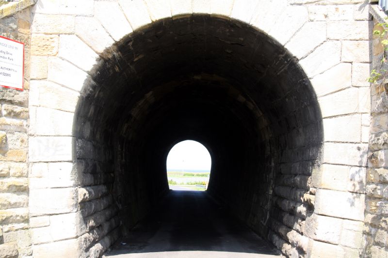
Tunnel, C1835, designed by George Stephenson for the Hartlepool Dock and Railway Company. Ashlar with ashlar dressings. Ashlar lined horse-shoe shaped tunnel with a rusticated archway at either end. The north archway is topped by chamfered coping, with side pilasters topped by ball finials, the angled sloping side walls are rock-faced ashlar with ashlar coping, and short terminating piers with ball finials., The south archway is similar, though the sloping side walls are plain ashlar without the terminating piers.
Listing NGR: NZ4918735833
External links are from the relevant listing authority and, where applicable, Wikidata. Wikidata IDs may be related buildings as well as this specific building. If you want to add or update a link, you will need to do so by editing the Wikidata entry.


Other nearby listed buildings