Approximate Location Map
Large Map »
Latitude: 51.0651 / 51°3'54"N
Longitude: -1.7956 / 1°47'44"W
OS Eastings: 414416
OS Northings: 129554
OS Grid: SU144295
Mapcode National: GBR 51F.2V2
Mapcode Global: FRA 7649.L8V
Plus Code: 9C3W3683+3P
Entry Name: Garden Wall of No 5 Running South Parallel with Road
Listing Date: 12 October 1972
Grade: II
Source: Historic England
Source ID: 1251993
English Heritage Legacy ID: 318964
ID on this website: 101251993
Location: The Friary, Wiltshire, SP1
County: Wiltshire
Civil Parish: Salisbury
Built-Up Area: Salisbury
Traditional County: Wiltshire
Lieutenancy Area (Ceremonial County): Wiltshire
Tagged with: Wall
1. THE CLOSE
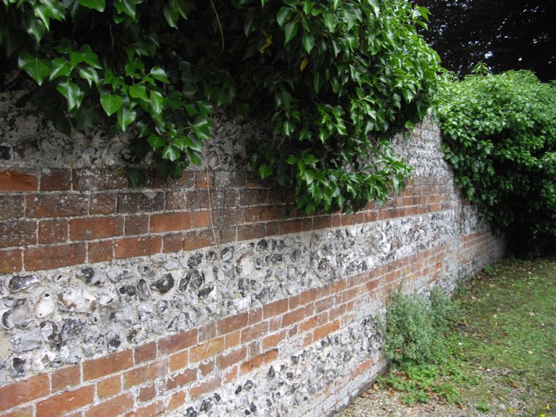
1594 Garden wall of No 5
running south parallel with
road
SU 1429 NW 3/57C
GV
II
2.
High garden wall of flint rubble with brick hands and coping.
All the listed buildings in the Close form an outstanding group.
Listing NGR: SU1441629554
External links are from the relevant listing authority and, where applicable, Wikidata. Wikidata IDs may be related buildings as well as this specific building. If you want to add or update a link, you will need to do so by editing the Wikidata entry.


Other nearby listed buildings
